
Local time Tuesday 4:01 AM | Time zone BRT/BRST (UTC-3/-2) | |
 | ||
Weather 18°C, Wind SE at 10 km/h, 93% Humidity University São Manuel Higher Education Municipal Institute | ||
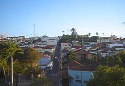
São Manuel is a municipality in the state of São Paulo in Brazil. The population is 40,367 (2015 est.) in an area of 651 km². The elevation is 709 m.
Contents
Map of S%C3%A3o Manuel, State of S%C3%A3o Paulo, Brazil
History
On April 19th, 1850, lieutenant Manoel Gomes de Faria, Dona Delfina Carolina Gomes, Antonio Joaquim Mendes, and Sinhorinha Rosa da Conceição, sponsored the foundation of Sao Manuel at Água Clara. On February 2, 1871, the location of the city was changed to Bairro do Paraízo, or the Tavares. The Chapel of St. Benedict was built and blessed in 1874. The date of foundation for the city is recorded as June 17, 1870.
People from São Manuel
References
São Manuel Wikipedia(Text) CC BY-SA