District Böblingen Time zone CET/CEST (UTC+1/+2) Area 16.24 km² Local time Saturday 9:30 AM Dialling code 07152 | Elevation 447 m (1,467 ft) Postal codes 71277 Population 10,196 (31 Dec 2008) Postal code 71277 Team SKV Rutesheim | |
 | ||
Weather 7°C, Wind E at 19 km/h, 70% Humidity | ||
Rutesheim is a German town located in Baden-Württemberg in the district of Böblingen.
Contents
- Map of Rutesheim Germany
- Location
- History
- Population development
- Mayor
- City Council
- Partnerships
- Religions
- Sports
- References
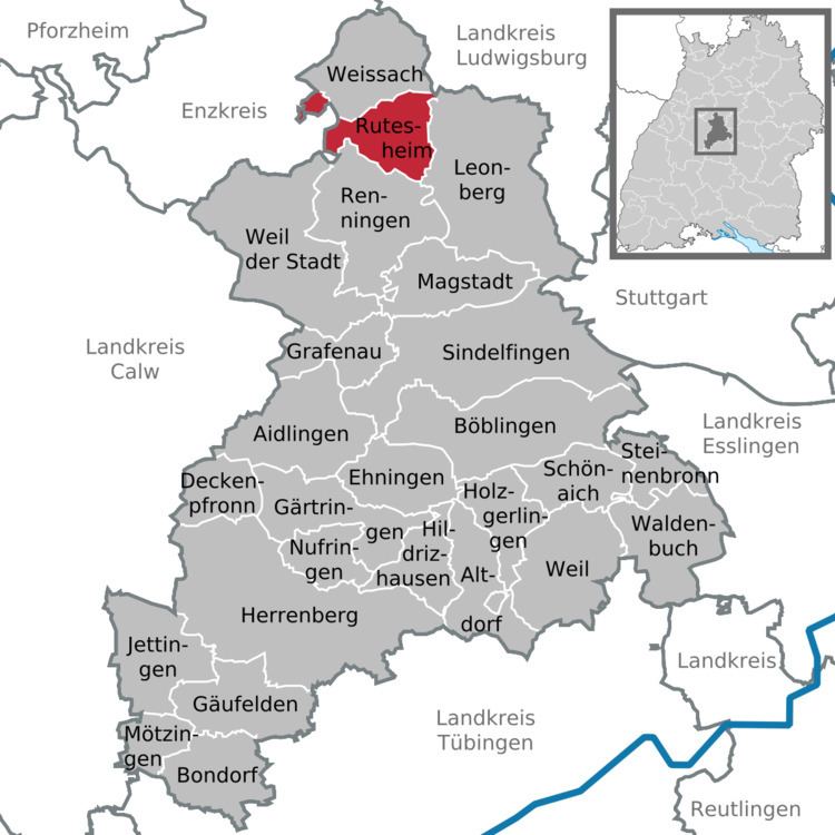
Map of Rutesheim, Germany
Location
Rutesheim is situated directly to the Highway 8 (Bundesautobahn 8), 5 kilometres (3 miles) from the town Leonberg, 18 km (11 mi) from the town Stuttgart and just 22 km (14 mi) from Airport Stuttgart and from the new exhibition center, 7 km (4 mi) way west from the town Heimsheim.´
History
Rutesheim was first mentioned in the year 767 in a deed from the convent of Lorsch.
The council of Ministers decided on 22. January 2008, to award Rutesheim on 1. July 2008 the designation town. Prime minister Oettinger assigned on 26. June 2008 the deed of the town in a ceremonial act.
Population development
The sources are census results (¹) or the data of the statistical office Baden-Württemberg.
Mayor
Since 2002 Dieter Hofmann is the mayor of the city. On January 2010 he was reelected for the next eight years with 98,2% of the votes.
City Council
The current legislative period lasts until 2014. Distribution of seats after the election of June 2009:
Partnerships
Religions
There are three Evangelic, one Evangelic-Methodistic and one Roman Catholic as well as two New-Apostolic churches in Rutesheim.
Sports
The most well-known sports club from Rutesheim is SKV Rutesheim. Its 1st football team is playing in the seven-rated Landesliga Württemberg.
