
Length 84 km | ||
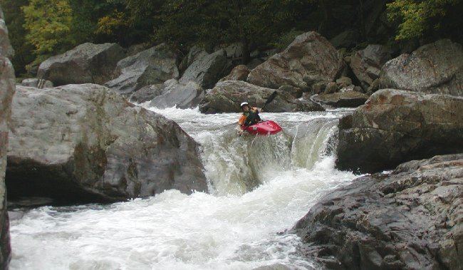 | ||
The Russell Fork is a 51.9-mile-long (83.5 km) tributary of the Levisa Fork in southwestern Virginia and southeastern Kentucky in the United States. Known for its whitewater, it rises in the Appalachian Mountains of southwest Virginia, in southern Dickenson County, and flows north through the town of Haysi, Virginia, the Breaks Interstate Park, and the town of Elkhorn City, Kentucky, in Pike County, where it flows into the Levisa Fork which, together with the Tug Fork, form the Big Sandy River.
Contents
Map of Russell Fork, United States
Fishing
The Russell Fork River below John W. Flannagan Dam in Dickenson County is the largest tail-water trout fishery in southwest Virginia. The cold-water release from the dam provides a unique habitat that is suitable for trout in this 1.6-mile stretch of the Russell Fork River. The Department manages this unique resource to provide both stocked trout and special regulation trout fishing opportunities. The first 0.4 miles directly below the dam is a stocked trout area and is managed as part of the Virginia catchable trout program. This section is a category "A" stocked trout water and is stocked with legal size trout (7 inches or larger) eight times from October through May. The remaining 1.2-miles below the stocked area begins at a sign posted on the riverbank that marks the start of the special regulation section.