
Population 1,389 2001 Census Civil parish Rusper Area 25.89 km² Dialling code 01293 | OS grid reference TQ205372 Sovereign state United Kingdom | |
 | ||
Rusper is a village and civil parish in the Horsham District of West Sussex, England. It lies 4.1 miles (6.6 km) north of the town of Horsham and 4.2 miles (6.8 km) west of Crawley. Rusper is the centre of Rusper Parish which covers most of the northern area between Horsham and Crawley. Rusper is governed by the Horsham District Council based in Horsham. The parish population at the 2001 census was 1,389 people.
Contents
Map of Rusper, Horsham, UK
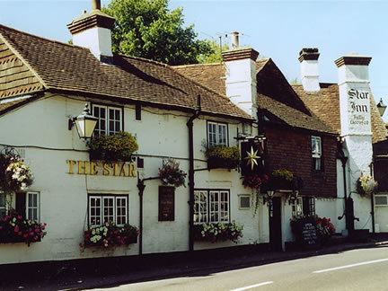
It has a range of local services (mainly located on the High Street) such as a village shop & post office, a residential care home, a park, a church, a recreational sports area consisting of a Football pitch and two Tennis courts (one with basketball hoops), a hotel, two pubs The Plough and The Star, a village hall, and Rusper Primary School, built in 1872.
Rusper is very close to London Gatwick Airport, which is only five miles away. It is on the watershed between the River Arun to the west and the River Mole to the east, with predominantly weald clay soils.
A Benedictine priory was established in the parish c.1200.