
Prominence 62 m OS grid SK111834 Elevation 550 m | Topo map OS Landranger 110 Listing Dewey | |
 | ||
Similar Brown Knoll, Grindslow Knoll, Lose Hill, Derwent Edge, Win Hill | ||
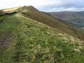
Rushup Edge is a ridge in the Derbyshire Peak District of England. The ridge's highest point is Lord's Seat at 550 m (1,804 ft), while Mam Tor lies at its eastern end, beyond which the Great Ridge runs.
Contents
Map of Rushup Edge, High Peak, UK
Lord's Seat is a round barrow.
Geology
Rushup Edge is part of the ridge which extends east to Mam Tor, Hollins Cross, Back Tor and Lose Hill, separating the Edale and Hope valleys. The ridge is formed of Namurian (c320mya) age Mam Tor Beds (alternating sandstone and siltstone) and landslides on the north have formed colluvium.
Protest
In October 2014, mountain bikers, walkers, horse riders, climbers and conservationists held a protest against Derbyshire County Council maintenance work on the byway that runs along Rushup Edge. They were upset at the insensitive nature of the work, the cost, the environmental impact and the apparent lack of consultation with them before works began. Derbyshire County Council halted the work to speak with protesters in December 2014.