
Country United States County Minidoka ZIP codes 83343, 83350 Elevation 1,267 m Population 5,617 (2013) Area code 208 | Time zone Mountain (MST) (UTC-7) FIPS code 16-70660 Area 5.41 km² Local time Friday 3:30 PM | |
 | ||
Weather 15°C, Wind S at 29 km/h, 24% Humidity | ||
Dangerous drive video notes from rupert idaho to tremonton utah 108 miles
Rupert is the county seat and largest city of Minidoka County, Idaho, United States. It is part of the Burley Micropolitan Statistical Area. The population was 5,554 at the 2010 census.
Contents
- Dangerous drive video notes from rupert idaho to tremonton utah 108 miles
- Map of Rupert ID 83350 USA
- Vlog in rupert idaho farm central area no visible growth maybe decline
- Geography
- 2010 census
- 2000 census
- History
- Notable people
- Education
- References
Map of Rupert, ID 83350, USA
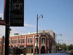
Rupert, founded in 1906, sprung up after the announcement of the Minidoka Reclamation Project, which provided irrigation and electricity following the completion of the Minidoka Dam in 1906. Electricity was plentiful after the building of the dam and led to Rupert being one of the first cities in the world to have its streets lighted by electricity.
Vlog in rupert idaho farm central area no visible growth maybe decline
Geography
Rupert is located at an elevation of 4,157 feet (1,267 m) above sea level. It is part of the agricultural region of the Snake River Plain known as Magic Valley, and is a few miles north of the Snake River. Interstate 84 passes a few miles to the south, and before its construction, U.S. Route 30 passed through Rupert. Acequia lies about 5 miles (8 km) northeast of Rupert and Paul is about the same distance to the west.
According to the United States Census Bureau, the city has a total area of 2.09 square miles (5.41 km2), all of it land.
2010 census
As of the census of 2010, there were 5,554 people, 2,026 households, and 1,397 families residing in the city. The population density was 2,657.4 inhabitants per square mile (1,026.0/km2). There were 2,186 housing units at an average density of 1,045.9 per square mile (403.8/km2). The racial makeup of the city was 75.0% White, 0.3% African American, 1.6% Native American, 0.4% Asian, 20.1% from other races, and 2.6% from two or more races. Hispanic or Latino of any race were 42.9% of the population.
There were 2,026 households of which 38.8% had children under the age of 18 living with them, 49.0% were married couples living together, 14.1% had a female householder with no husband present, 5.8% had a male householder with no wife present, and 31.0% were non-families. 26.8% of all households were made up of individuals and 14.2% had someone living alone who was 65 years of age or older. The average household size was 2.71 and the average family size was 3.30.
The median age in the city was 33.3 years. 30.4% of residents were under the age of 18; 9.6% were between the ages of 18 and 24; 23.2% were from 25 to 44; 21.8% were from 45 to 64; and 15% were 65 years of age or older. The gender makeup of the city was 49.0% male and 51.0% female.
2000 census
As of the census of 2000, there were 5,645 people, 2,024 households, and 1,443 families residing in the city. The population density was 2,779.9 people per square mile (1,073.7/km²). There were 2,204 housing units at an average density of 1,085.4 per square mile (419.2/km²). The racial makeup of the city was 72.65% White, 0.37% African American, 1.17% Native American, 0.32% Asian, 0.02% Pacific Islander, 22.69% from other races, and 2.78% from two or more races. Hispanic or Latino of any race were 35.39% of the population.
There were 2,024 households out of which 38.3% had children under the age of 18 living with them, 54.5% were married couples living together, 12.5% had a female householder with no husband present, and 28.7% were non-families. 25.2% of all households were made up of individuals and 12.7% had someone living alone who was 65 years of age or older. The average household size was 2.75 and the average family size was 3.31.
In the city, the population was spread out with 31.2% under the age of 18, 10.6% from 18 to 24, 25.0% from 25 to 44, 18.8% from 45 to 64, and 14.3% who were 65 years of age or older. The median age was 32 years. For every 100 females there were 90.8 males. For every 100 females age 18 and over, there were 86.7 males.
The median income for a household in the city was $25,105, and the median income for a family was $29,423. Males had a median income of $28,070 versus $16,779 for females. The per capita income for the city was $12,253. About 18.9% of families and 21.5% of the population were below the poverty line, including 29.2% of those under age 18 and 11.7% of those age 65 or over.
History
In 2006, Rupert celebrated its 100th birthday.
Rupert officially became "Christmas City, USA" in November 1987.
Notable people
Education
Rupert is served by the Minidoka County Schools system.
Children are zoned to: