
 | ||
Location City of Brussels, Brussels-Capital Region, Belgium | ||
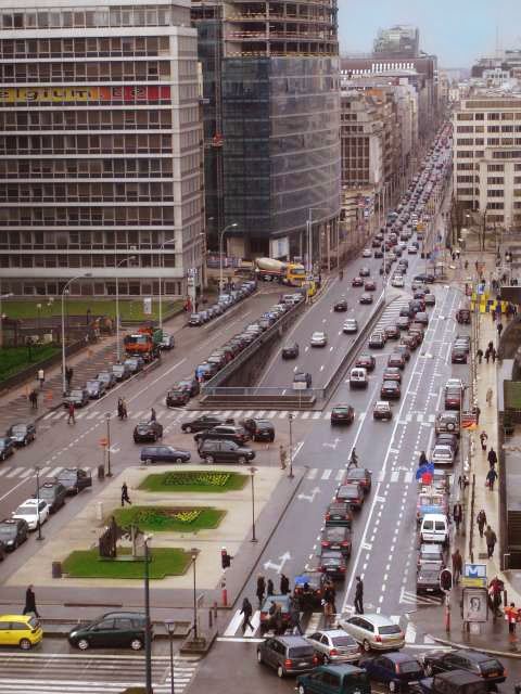
Rue de la Loi (French) or Wetstraat (Dutch) is a principal road running through central and eastern Brussels (Belgium) which is famous due to the presence of several notable governmental buildings (of Belgium and the European Union). The road, whose name translates into English as Law Street, runs from Rue Royale/Koningsstraat ( 50.8468°N 4.3625°E / 50.8468; 4.3625), almost in the centre of Brussels, to Schuman roundabout (50.8419°N 4.3859°E / 50.8419; 4.3859), in its European quarter. It forms the first (westerly) part of the N3 motorway that runs to Aachen, Germany.
Contents
Map of Rue de la Loi, 1000 Bruxelles, Belgium
The term Rue de la Loi or Wetstraat is often used in the Belgian media as a metonym for government because not only the Belgian Federal Parliament is at the beginning of this street, but also the office of the prime minister at number 16. At the far end is the Berlaymont building on the Schuman roundabout and Cinquantenaire beyond that. Shortly before the roundabout, the central part of the road sinks underground into the subterranean Belliard Tunnel (the continuation of the N3 motorway) that runs under the roundabout and Cinquantenaire.
Buildings
The street starts, flowing off from Rue des Colonies/Koloniënstraat, intersecting with Rue Royale/Koningsstraat. Immediately to the south is Parc metro station and Brussels Park. To the north is the Belgian Parliament building on the Palais de la Nation/Natieplein. The Théâtre Royal du Parc is also situated here.
History
The road was redeveloped into a higher capacity one way thoroughfare in 1969 with the first metro line being built under it. In 2001 it was proposed that one lane of the road should be removed and the pavements extended to include cycleways. This, together with an overall face-lift, was completed on 7 September 2003 and immediately calls rose for the reversal of traffic flow (see redevelopment below).
Redevelopment
As part of plans to improve the image of the European Quarter, the eastern part of the Rue de la Loi/Wetstraat running through the quarter (between the small ring and the Chaussée d'Etterbeek/Etterbeeksesteenweg) will rebuilt. In April 2008 the Brussels-Capital Region (the regional authority), together with the European Commission and the City of Brussels (the local authority) launched an international urban design competition to redevelop the area as an eco-district, concentrating on improving pedestrian and public transport access. They stated it should include more public spaces and have a "strong symbolic identity" with high environmental and architectural standards. Furthermore, they aimed to diversify the area by bringing in more housing, cultural and leisure areas while simultaneously increasing the area occupied by the Commission from 170,000 m² to 400,000 m² - doubling the building density along the street.
In March 2009, a French-Belgian-British team led by French architect Christian de Portzamparc won the competition and Siim Kallas stated that the project, which would be put into action over a few a long period rather than all at once, would create a "symbolic area for the EU institutions" giving "body and soul to the European political project" and providing the Commission with extra office space. The road would be reduced from four lanes to two, and be returned to two way traffic (rather than all west-bound) and the architects proposed a tram line to run down the centre. A series of high rise buildings would be built on either side with three 'flagship' skyscrapers at the east end on the north side. Brussels Minister-President Charles Picqué described the towers as "iconic buildings that will be among the highest in Brussels" and that "building higher allows you to turn closed blocks into open spaces." The tallest towers at the eastern end would be subject to a separate architectural competition and would be symbolic of the Commission. The freed up space (some 180,000m²) would be given over to housing, shops, services and open spaces to give the area a more "human" feel. A sixth European School may also be built. On the western edge of the quarter, on the small ring, there would be "gates to Europe" to add visual impact.
The general quarter master plan saw not only the road being reduced from four lanes to two, but the tunnel entrance being covered as far as Résidence Palace, and a new square between the Rue d'Arlon/Aarlenstraat and Rue de Trêves/Trierstraat.