
Airport type Public Elevation AMSL 87 ft / 27 m 2,000 610 Phone +1 251-824-4538 | Owner Hillery W. Grice 18/36 2,000 Elevation 27 m | |
 | ||
Address 11317 Airport Rd, Irvington, AL 36544, USA Similar St Elmo Airport‑2R5, Mobile Regional Airport, Richardson Field, Dauphin Island Airport, Mobile Aeroplex at Brookley | ||
Roy e ray airport eaa fly in mike mclaughlin takes me over dauphin island
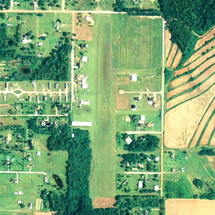
Roy E. Ray Airport (FAA LID: 5R7) is a privately owned, public-use airport located three nautical miles (4 mi, 6 km) northeast of the central business district of Bayou La Batre, a city in Mobile County, Alabama, United States.
Contents
- Roy e ray airport eaa fly in mike mclaughlin takes me over dauphin island
- Roy e ray airport eaa fly in piper cherokee takeoff
- Facilities and aircraft
- References
Roy e ray airport eaa fly in piper cherokee takeoff
Facilities and aircraft
Roy E. Ray Airport covers an area of 41 acres (17 ha) at an elevation of 87 feet (27 m) above mean sea level. It has one runway designated 18/36 with a turf surface measuring 2,000 by 150 feet (610 x 46 m).
For the 12-month period ending May 12, 2011, the airport had 6,978 aircraft operations, an average of 19 per day. At that time there were 35 aircraft based at this airport: 91% single-engine, 6% multi-engine and 3% ultralight.
References
Roy E. Ray Airport Wikipedia(Text) CC BY-SA