
- elevation 1,121 ft (342 m) - average 728 cu ft/s (21 m/s) Discharge 20.61 m³/s | - elevation 617 ft (188 m) Length 32 km | |
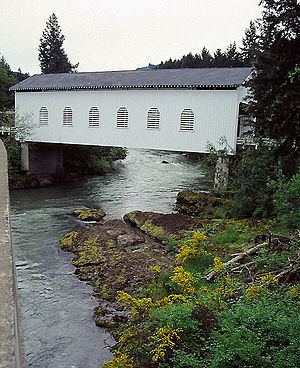 | ||
- max 21,400 cu ft/s (606 m/s) Bridges Currin Bridge, Dorena Bridge | ||
Waterfalls of oregon row river
The Row River is a river, approximately 20 miles (32 km) long, in Lane County, Oregon, United States. It rises in the Cascade Range and flows into the Coast Fork Willamette River near Cottage Grove. The stream was originally known as the "East Fork Coast Fork", but was later renamed after a dispute (row) between neighbors and brothers-in-law George Clark and Joseph Southwell over "trespassing" livestock. Clark was killed as a result of the row. The name rhymes with "cow" rather than with "slow". A post office named Row River operated from 1911 to 1914 a little north of the present site of Dorena at 43.740123°N 122.880347°W / 43.740123; -122.880347.
Contents
- Waterfalls of oregon row river
- Map of Row River Oregon USA
- Explore oregon recreation row river trail
- CourseEdit
- DischargeEdit
- References
Map of Row River, Oregon, USA
Explore oregon recreation row river trail
CourseEdit
The Row River, about 20 miles (32 km) long, drains a portion of the Umpqua National Forest on the west face of the central Oregon Cascades between Cottage Grove and Oakridge. Its headwaters are near the unincorporated community of Disston, where Layng Creek and Brice Creek join at 43.70331°N 122.77093°W / 43.70331; -122.77093 (Row River source). The river flows predominately westward.
About 1 mile (1.6 km) below Disston, Gleason Creek enters from the right bank, and about 1 mile (1.6 km) later, the Row receives Hunt Creek from the right and passes over 15-foot (4.6 m) Wildwood Falls at 43.699845°N 122.818954°W / 43.699845; -122.818954 (Wildwood Falls). A quarter-mile (500 m) later it passes through Lasells D. Stewart Park, and 1 mile (1.6 km) later through the community of Culp Creek, where it receives Sharps Creek and then Culp Creek, both from the left bank. Turning northwards, the river receives Hawley Creek from the left just above river mile (RM) 15 or river kilometer (RK 24) and shortly thereafter flows through Dorena. At RM 14 (RK 23), Cedar Creek enters from the right. Soon the river turns sharply west, passes a United States Geological Survey (USGS) stream gauge at RM 13.2 (RK 21.2), and turns to the northwest. Over the next stretch, it receives Pitcher Creek, King Creek, and Anderson Creek, all from the left, before entering Dorena Lake at RM 11 (RK 18).
While part of the lake, the Row River receives Vaughn Creek from the left, Smith Creek from the right, Bluff Creek from the left, Rat Creek from the right, and Baker Creek from the left before reaching Dorena Dam and spillway at about RM 7.5 (RK 12.1). The river passes a second USGS stream gauge 5.5 miles (8.9 km) from the mouth, and soon Hann's Creek enters from the right. In its final 5 miles (8 km), the river receives Mosby Creek from the left, turns northwest, flows by Cottage Grove State Airport, and passes under Interstate 5 before entering the Coast Fork Willamette River just below the larger stream's RM 21 (RK 34).
DischargeEdit
The USGS monitors the flow of the Row River at two gauges, one near Dorena, 13.2 miles (21.2 km) from the mouth and the other above Cottage Grove, 5.5 miles (8.9 km) from the mouth. The average flow of the creek at the Dorena gauge is 589 cubic feet per second (16.7 m3/s). This is from a drainage area of 211 square miles (546.5 km2). The maximum flow recorded there was 33,100 cubic feet per second (940 m3/s) on December 22, 1964, and the minimum flow was 9.7 cubic feet per second (0.27 m3/s) on September 4–6, 2003. At the Cottage Grove gauge, the average flow is 728 cubic feet per second (20.61 m3/s). This is from a drainage area of 270 square miles (700 km2). The maximum flow recorded there was 21,400 cubic feet per second (606 m3/s) on December 28, 1945, and the minimum flow was 0.20 cubic feet per second (0.0057 m3/s) from September 25 to October 7, 1958.