
Existed: 1932 – present Length 9.19 km | Constructed 1932 | |
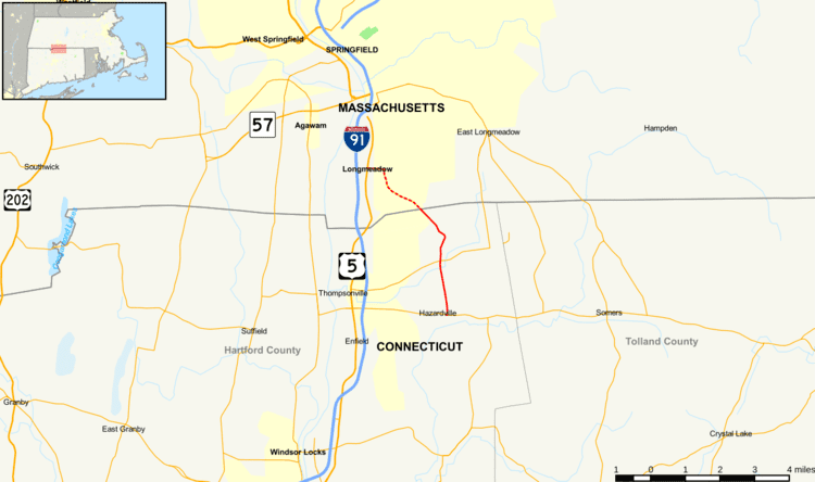 | ||
Route 192 is a state route in the U.S. states of Connecticut and Massachusetts, serving the southeastern suburbs of the Springfield metropolitan area. It connects the Hazardville section of the town of Enfield to the town center of Longmeadow, Massachusetts. The Massachusetts portion of the route is a town-maintained road.
Contents
Map of CT-192, Enfield, CT 06082, USA
Route description
Route 192 begins as North Maple Street at an intersection with Route 190 in the Hazardville section of Enfield. It heads north to the village of North Thompsonville, where it intersects with Route 220. It continues north until Shaker Pines Lake, where the road then curves to the west. After about 0.3 miles (0.48 km), the road splits, with Route 192 following the right branch northwest towards the Massachusetts state line. The road continues north across the state line as Shaker Road towards the town center of Longmeadow. After 1.7 miles (2.7 km), Route 192 turns west onto Williams Street until it ends at an intersection with U.S. Route 5. Route 192 is a two-lane secondary road for its entire length. It is classified as a minor arterial road and carries traffic volumes of about 4,400 vehicles per day.
History
Route 192 was established as a new route in Connecticut during the 1932 state highway renumbering. Massachusetts extended the route number into Longmeadow at roughly the same time. Route 192 has not had any significant changes since it was designated.