
Intercommunality Centre Littoral INSEE/Postal code 97310 /97311 Local time Thursday 6:57 AM | Population (2012) 3,050 Area 3,902 km² | |
 | ||
Elevation 0–462 m (0–1,516 ft)(avg. 231 m or 758 ft) Weather 25°C, Wind NE at 3 km/h, 89% Humidity | ||
Pdg les tutos les spots de p che en guyane 1 le pont de roura et l acoupa rivi re
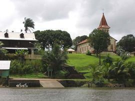
Roura is a commune of French Guiana, an overseas region and department of France located in South America.
Contents
- Pdg les tutos les spots de p che en guyane 1 le pont de roura et l acoupa rivi re
- Map of Roura French Guiana
- Commune de roura
- Location
- Roads
- References
Map of Roura, French Guiana
Commune de roura
Location
The city of Roura is bordered by Matoury and Montsinéry-Tonnegrande in the North, Kourou and Saint-Elie in the North West and West, and finally by Régina in the South and East.
Roads
The city of Roura is home to 2 main roads.
References
Roura Wikipedia(Text) CC BY-SA