
Locks unknown | ||
 | ||
Status Proposed river navigation Connects to | ||
The Rother Link is a planned English canal that would connect the Chesterfield Canal at Killamarsh, via the River Rother through to the Sheffield and South Yorkshire Navigation, thus creating a new cruising ring and encouraging boats to visit the Chesterfield Canal.
Contents
Proposals
The Rother Link was first suggested in early 1995, when the Chesterfield Canal Society submitted their proposal to the National Rivers Authority for the conversion to navigable status of the 8-mile (13 km) section of the River Rother from Killamarsh to Rotherham. The link has been adopted as an official goal by the Chesterfield Canal Partnership, a group of Councils at District and County level, working together with British Waterways and the Chesterfield Canal Trust. The councils consist of Derbyshire County Council, Chesterfield Borough Council, N E Derbyshire District Council, Rotherham Metropolitan Borough Council, Bassettlaw District Council and Nottinghamshire County Council.
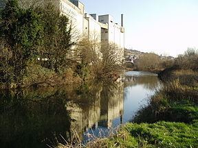
The route diagram shows existing roads and railways which cross the River Rother between the Rother Valley Country Park and Rotherham. As there is a drop of around 14m between these two points, several locks would be required, and the waterway would consist of a number of river sections with cuts to accommodate the locks.
The route of the river is quite easy to follow, as the Trans Pennine Trail runs along the river bank from Rotherham to the A631 bridge, and then follows the valley to Rother Valley Country Park, on its way to Chesterfield. The Trans Pennine Trail is a long distance footpath, connecting Liverpool, Leeds, Hull and Chesterfield, and is suitable for walking and cycling, with some sections suitable for horse riding.
Precursors
The idea of a link between the Chesterfield Canal and the River Don system is not new. Benjamin Outram, reporting to those planning the Sheffield Canal in 1793 proposed an extension to his Eckington, Beighton, Attercliffe and Tinsley route, which would use five narrow locks to join up with the Chesterfield Canal, at a cost of £4,175. Neither the main route, nor the extension were pursued. In 1810, a proposal to link Rotherham to the Chesterfield Canal was made by Richard Gresley. This was the North Eastern Junction Canal, and envisaged a link from the Chesterfield Canal to the Cromford Canal as well, but the scheme met with little enthusiasm.
In 1814, the Sheffield Canal promoters were considering two schemes, one to the north of the River Don, and one to the south, and the southern route was preferred because it would make a future link to the Chesterfield Canal easier to construct. The idea was revived in June 1832, with a proposal for a Sheffield and Chesterfield Junction Canal, which would run from the top of the locks at Sheffield to Killamarsh forge on the Chesterfield Canal. The 7.7-mile (12.4 km) canal, requiring two locks, was costed at £46,204 by the engineer Joseph Burke. A further report was made in October 1832 by George Leather, who included some improvements and revised the cost to £75,870. With no interest being shown by the River Don Navigation, the project foundered due to the failure to raise the necessary finance.