
Country Language spoken | State District | |
Colleges and Universities Indian Institute of Technology Roorkee, College of Engineering Roorkee, University of Roorkee | ||
Roorkee (Hindi: Rurki) is a city in Haridwar district, Uttarakhand(Hindi:??????????), that is spread over a flat terrain with the grand spectacle of Himalayas ranges flanking it in the East and the North-east. It is on the banks of the Ganges canal on the national highway 58 (Delhi - Sri Badnrinath - Mana) between Delhi and Dehradun. Also the National Highway 73, connecting Roorkee (Uttarakhand) and Panchkula (Haryana) originates from here. The dominant feature of the city is the Upper Ganges Canal which flows north-south and bisects the city. Also known for Roorkee Cantonment, one of the countrys oldest, and the headquarters of Bengal Engineer Group (Bengal Sappers) since 1853. The renowned IIT Roorkee is located in this city.
Contents
- Map of Roorkee
- Iit roorkee official video
- Iit roorkee
- History
- Geography
- Order food online in dehradun haridwar rishikesh roorkee
- References
Map of Roorkee
Iit roorkee official video
Iit roorkee
History
Roorkee was the capital of a Moghul Mahal (similar to a present-day Pargana) during the time of Akbar, as is referred in Ain-e-Akbari, authored by Abul-Fazl ibn Mubarak.
During the 18th century, it came under the rule of Landhaura state, until the death of its Gurjar king, Raja Ramdayal in 1813. It later became a part of the territories of the British East India Company.
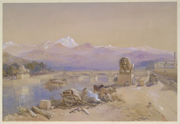
Before 1840, the city was a tiny hamlet consisting of mud huts on the banks of the Solani rivulet. Digging work on the Upper Ganges Canal formally began in April 1842, under the aegis of Proby Cautley, a British officer. Soon, Roorkee developed into a town. The canal, which was formally opened on 8 April 1854, irrigated over 767,000 acres (3,100 km²) in 5,000 villages.
To look after the maintenance of canal the Canal Workshop and Iron Foundry were established in 1843 in the civil lines on the canal bank which is known as Irrigation workshop nowadays . This was followed by the establishment of Civil Engineering School; classes started in 1845 to train local youth to assist in the civil-engineering work of the Upper Ganges Canal. This was to become the first engineering college established in India. On November 25, 1847, the college was formally constituted, through a proposal by the Sir James Thomason, Lt. Governor of North Western Province (1843–53). After his death in 1853, the college was rechristened as Thomason College of Civil Engineering. The college later upgraded to University of Roorkee in 1949; on September 21, 2001, through an Act of parliament, it was made one of the Indian Institutes of Technology, IIT Roorkee. In 1853 Bengal Sappers and Miners were stationed here which provided a controlling influence during the 1857 uprising. Other important events in the history of Roorkee are: Under the Post Office Act 1866, it was among the first few towns to have a post office and first telegraphic office in the district. Now Roorkee has a General Post Office (GPO) and a number of post offices located in Roorkee City and Cantt. In 1886, Roorkee was placed on the Railway map of India. In 1907, first provincial trunk road Meerut-Roorkee-Dehradun was constructed. In 1920, Roorkee became the first town in Uttar Pradesh to have Hydroelectricity.
Indias first aqueduct was constructed over the Solani river, near Roorkee, part of the Ganges Canal project, which itself was Indias first irrigation work in North India, started by the British. The Ganges Canal led to another first for Roorkee — Indias first steam engine, Mary Lind, (specially shipped from England moved on rails in India) ran in Roorkee on December 22, 1851, between Roorkee and Piran Kaliyar, two years before the first passenger train ran from Bombay to Thane in 1853. Operated by the Bengal Sappers, the railway line was built to carry soil used for the construction of the Upper Ganges Canal aqueduct from Piran Kaliyar, 10 km (6.2 miles) from the city. The locomotive rail paths are still intact. A replica of what the locomotive is thought to have looked like is exhibited at Roorkee Railway Station.
The municipality of Roorkee was created in 1868. Now it is a Municipal Corporation. It had been home to the Bengal Sappers and Miners since 1853, and two artillery units were stationed there. Today, the Roorkee Cantonment has a large army base. The Bengal Engineering Group and Centre (BEG&C), are still there today.
In 1901, when the city had a population of 17,197, it was made headquarters of the Roorkee Tehsil, in Saharanpur district of the United Province of the British Raj; the tehsil included in it 426 villages (of the parganas of Jwalapur, Manglaur and Bhagwanpur) and six towns, most important among them being Haridwar and Manglaur. The Old Cemetery in the city is a protected monument, by the Archaeological Survey of India.
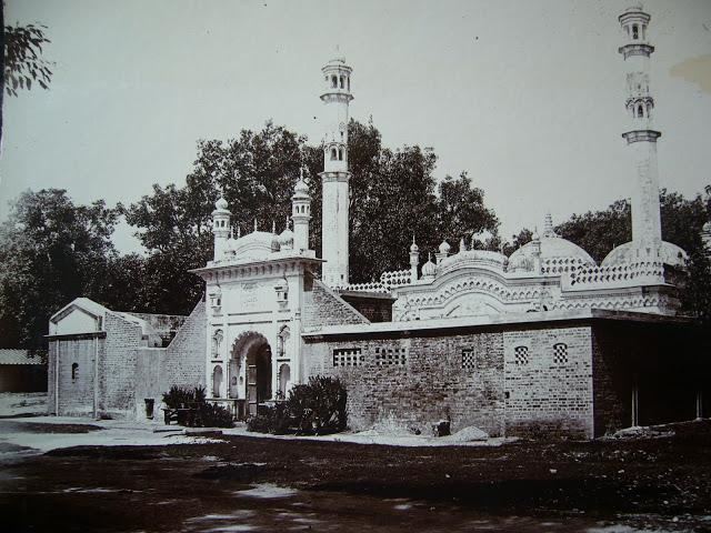
Roorkee is also famous for the shrine of 13th century Sufi saint Alauddin Sabir Kaliyari — the dargah is also known as Sarkar Sabir Pak — in Piran Kaliyar village, where an annual 15-day spiritual fair (Urs) is held.
Geography
Roorkee is located at 29.87°N 77.88°E? / 29.87; 77.88. It has an average elevation of 268 metres (879 feet).
Roorkee is 172 kilometres (107 mi) north of the Indian capital, New Delhi between the rivers Ganges and Yamuna, close to the foothills of the Himalayas. Before the creation of Uttarakhand on November 9, 2000, Roorkee was a part of the state of Uttar Pradesh.