
Country United States GNIS feature ID 0429665 Area 94.04 km² Population 1,669 (2010) | Time zone CST (UTC-6) Elevation 161 m Local time Wednesday 3:24 AM | |
 | ||
ZIP codes 62830, 62864, 62889, 62893, 62898 Weather 5°C, Wind NE at 16 km/h, 73% Humidity | ||
Rome Township is one of sixteen townships in Jefferson County, Illinois, USA. As of the 2010 census, its population was 1,669 and it contained 771 housing units.
Contents
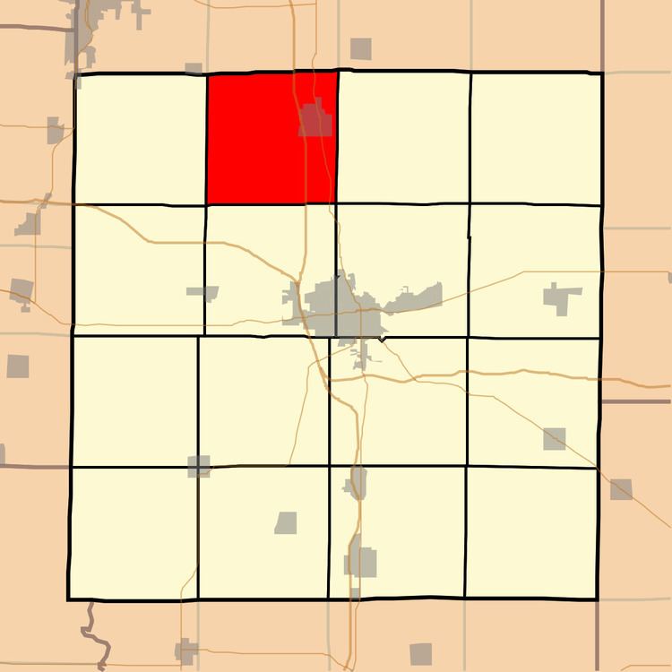
- Map of Rome Township IL USA
- Geography
- Cities towns villages
- Unincorporated towns
- Adjacent townships
- Cemeteries
- Major highways
- Political districts
- References
Map of Rome Township, IL, USA
Geography
According to the 2010 census, the township has a total area of 36.31 square miles (94.0 km2), of which 36.25 square miles (93.9 km2) (or 99.83%) is land and 0.05 square miles (0.13 km2) (or 0.14%) is water. The township is centered at 38°26'N 88°59'W (38.430, −88.976). It is traversed north-south by Interstate Route 57 and State Route 37.
Cities, towns, villages
Unincorporated towns
(This list is based on USGS data and may include former settlements.)
Adjacent townships
Cemeteries
The township contains these seven cemeteries: Boyd, Boyd Farm, Ebenezer, Gilead, Jennings Farm, Little Grove and Pleasant Hill.
Major highways
Political districts
References
Rome Township, Jefferson County, Illinois Wikipedia(Text) CC BY-SA