
Population 244 (2006 census) Local time Wednesday 2:07 AM | Postcode(s) 3330 Postal code 3330 Federal division Division of Corangamite | |
 | ||
Location 133 km (83 mi) W of Melbourne69 km (43 mi) NW of Geelong44 km (27 mi) S of Ballarat Weather 17°C, Wind S at 21 km/h, 92% Humidity | ||
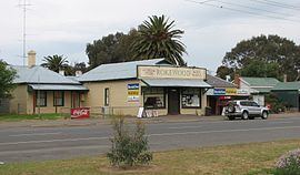
Rokewood is a small rural township in Victoria, Australia in the Golden Plains Shire, 133 kilometres (83 mi) west of the state capital, Melbourne. At the 2006 census, Rokewood and the surrounding area had a population of 244.
Contents
Map of Rokewood VIC 3330, Australia
History
Rokewood Post Office opened on 1 October 1857.
McMillans Bridge, which crosses the Woady Yaloak River for the Rokewood-Skipton Road between Rokewood and Werneth, is listed on the Victorian Heritage Register.
Sport
In conjunction with its neighbouring township Corindhap Rokewood has an Australian Rules football team, Rokewood-Corindhap. It previously competed in the Lexton Plains Football League, but the league folded at the end of the 2010 season. The team now play in the Central Highlands Football League
Golfers play at the course of the Rokewood Golf Club on Rokewood - Shelford Road.