
Postcode(s) 3329 Postal code 3329 | Shelford BamganieTeesdale | |
 | ||
Location 106 km (66 mi) W of Melbourne42 km (26 mi) W of Geelong18 km (11 mi) W of Bannockburn | ||
Shelford is a rural locality in Victoria, Australia. The locality is in the Golden Plains Shire near the regional city of Geelong and 106 kilometres (66 mi) west of the state capital, Melbourne.
Contents
Map of Shelford VIC 3329, Australia
The Post Office opened on 1 July 1847 as The Leigh and was renamed Shelford in 1854. It became a Licensed Post Office on 20 May 1994, and has since closed; the date of closure is unknown.
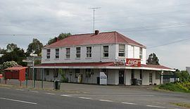
Heritage listed sites
Shelford contains a number of heritage listed sites, including:
References
Shelford, Victoria Wikipedia(Text) CC BY-SA