
Season All year Round Length 168,000 m | Highest point 157 metres (515 ft) Sight Sherwood Forest | |
 | ||
Property 22 robin hood way drouin for sale barry plant pakenham candice johnston
The Robin Hood Way is a waymarked long-distance footpath in the Midlands of England in the United Kingdom.
Contents
- Property 22 robin hood way drouin for sale barry plant pakenham candice johnston
- Map of Robinhood Way Sherwood WI 54169 USA
- Length of the Route
- The route
- References
Map of Robinhood Way, Sherwood, WI 54169, USA
Length of the Route
The Robin Hood Way runs for 168 kilometres (104 mi).
The route
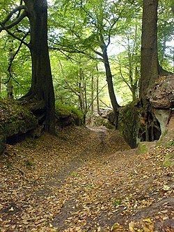
The Robin Hood way commemorates the famous folklore figure Robin Hood and starts from Nottingham Castle running to Edwinstowe.
Its passes through Sherwood Forest taking in Clumber Park, Farnsfield, Greasley, Kimberley, Rainworth, Creswell Crags, Kirton and Bothamsall.
References
Robin Hood Way Wikipedia(Text) CC BY-SA