
Primary inflows Basin countries United States Average depth 4 ft (1.2 m) Area 50 ha | Surface area 124 acres (50 ha) Max. depth 5 ft (1.5 m) Mean depth 1.22 m Inflow source Poor Meadow Brook | |
 | ||
Similar Lake Nippenicket, Burrage Pond Wildlife M, Oldham Pond, Indian Head Pond, Norton Reservoir | ||
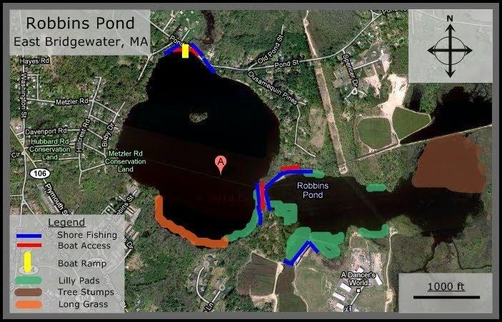
Robbins Pond is a 124-acre (0.50 km2) warm water pond in East Bridgewater and Halifax, Massachusetts. It is part of the Taunton River Watershed. The inflow is Poor Meadow Brook, and the outflow is the Satucket River.The water is brown in color with a transparency of five feet, and the bottom is a mixture of sand and gravel. Average depth is four feet and maximum depth is just ten feet. There are 1.7 miles (2.7 km) of shoreline.
Map of Robbins Pond, Massachusetts, USA
The pond is located off Pond Street in East Bridgewater, one mile (1.6 km) from Route 106. Access is an informal gravel launch area near the pond’s outlet. It is suitable only for car top boats and canoes.
References
Robbins Pond (Massachusetts) Wikipedia(Text) CC BY-SA