
Airport type Public 9/27 5,401 Code RAL Phone +1 951-351-6113 | Operator City of Riverside Elevation AMSL 819 ft / 250 m 5,401 1,646 Elevation 249 m | |
 | ||
Address 6951 Flight Rd, Riverside, CA 92504, USA | ||
Riverside municipal airport kral landing
Riverside Municipal Airport (Riverside Arlington Airport, decades ago) (IATA: RAL, ICAO: KRAL, FAA LID: RAL), is four miles (6 km) southwest of downtown Riverside, the county seat of Riverside County, California.
Contents
Scheduled flights to Laughlin/Bullhead International Airport (Arizona) on Western Express Air ended when that airline ceased operations at the end of May 2007.
Runway 9/27 was paved about 1956 and Bonanza Air Lines appeared soon after. Until 1969 it and successor Air West flew DC-3s and Fairchild F-27s to LAX, Las Vegas, Palm Springs and beyond. Golden West Airlines served Riverside during the 1970s with nonstop and direct de Havilland Canada DHC-6 Twin Otters to LAX.
Riverside Municipal Airport has been home to Civil Air Patrol Squadron 5 since 2005.
"FedEx Express donated a Boeing 727-200F to California Baptist University for its new aviation science program. The aircraft will be on permanent display at the airport and will provide a working laboratory for aviation science students." The aircraft, N266FE (cn 21672/1538), is a Boeing 727-233/Adv(F). A video of its arrival on January 10, 2013 can be found here.
Facilities
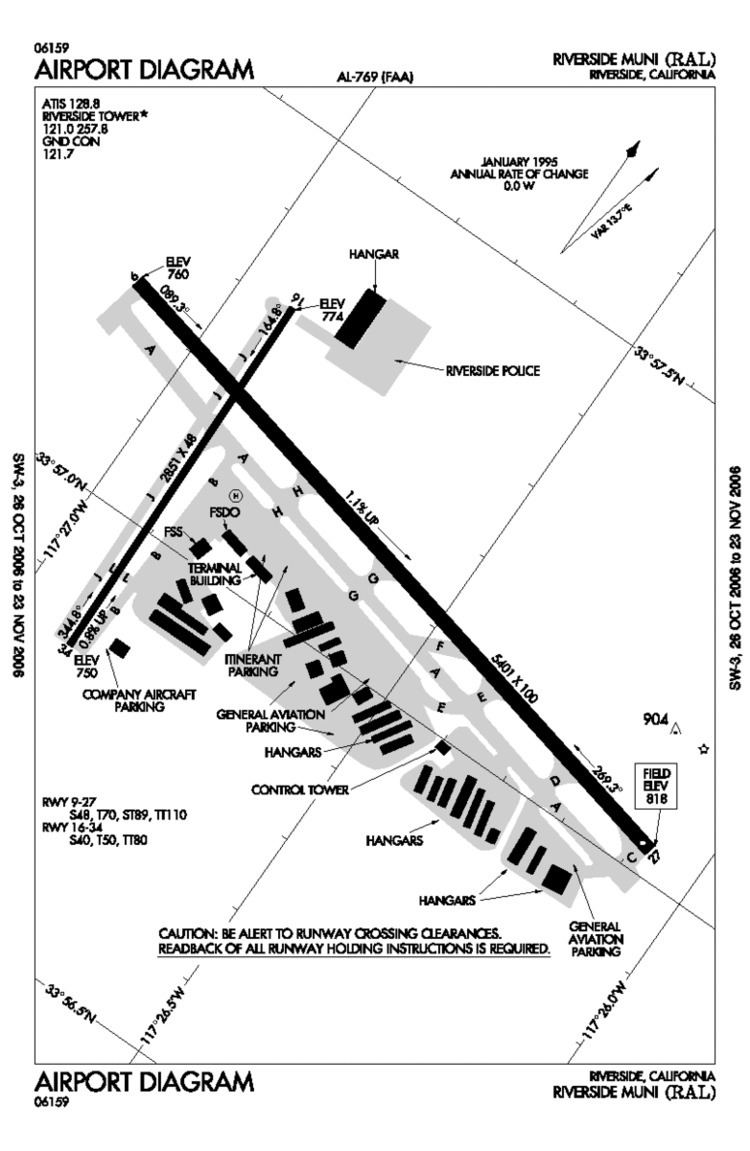
The airport covers 525 acres (212 ha) and has two runways and one helipad:
The runway has ILS, GPS, and VOR approaches.
Should there be plans to expand, the Airport's Master Plan supports lengthening runway 9/27 to 6,153 feet (1,875 m). Runway 27 has a Visual Approach Slope Indicator.
The crosswind runway, RWY 16-34, is suited for smaller aircraft. Runway 34 has a Precision Approach Path Indicator.