
Basin area 193 km² | Country United Kingdom | |
 | ||
- location | ||
The River Smite is a tributary of the River Devon, that flows for 20 miles (32 km) through Leicestershire and Nottinghamshire, England. The source is to be found near to the hamlet of Holwell, in Leicestershire and it joins the River Devon near Shelton. The Smite and its tributaries, which include the River Whipling, the Stroom Dyke, and the Dalby Brook, drain an area of 193 square kilometres (75 sq mi) of agricultural land in the Vale of Belvoir.
Contents
Map of River Smite, United Kingdom
NameEdit
In the 17th century the river was known as the Snite, this and the modern spelling are thought to derive from the Old English word 'Smita' denoting a 'foul or miry place', which is linked to another OE word 'Smitan', which means to daub or pollute. This indicates that the name Smite means 'the dirty, miry stream.'
CourseEdit
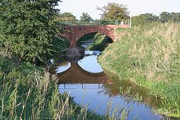
The various tributary streams that descend from the Bleak Hills join the Smite as it flows in a north-westerly direction, before it turns north-east as it reaches the bottom of the escarpment and the lower lying Vale of Belvoir. It is spanned by an aqueduct of the Grantham Canal, and then continues in a north-westerly direction, where it meets Dalby brook. This tributary drains the south-west of the catchment, rising near Old Dalby, before flowing between Upper and Nether Broughton, and past Hickling to the junction with the Smite. Beyond this confluence the river flows through Colston Bassett and beside Wiverton Hall, where it is joined by the Stroom Dyke. It continues through farmland, until it reaches the A52 where it then passes between the villages of Whatton in the Vale and Aslockton. It is joined by the River Whipling, as it flows past the remains of the motte and bailey of Aslockton Castle. The river continues in a north-easterly direction, flowing beside the villages of Orston, Thoroton, Flawborough and then Shelton where it meets the River Devon.
River WhiplingEdit
The River Whipling is the main tributary of the River Smite, and is 6 miles (9.7 km) long. The source of the river is the confluence of its two tributaries, the Rundle Beck and The Grimmer which meet near Granby. The Whipling then flows around the village, before taking a north-easterly course to join the Smite near Whatton in the Vale. The Whipling and its tributaries drain an area of 52 square kilometres (20 sq mi) of the Vale of Belvoir, and so contribute approximately a quarter of the catchment area of the Smite.