
Country United States County Wayne Incorporated (city) 1922 Elevation 178 m Population 7,676 (2013) Area code 313 | Incorporated (village) 1899 Time zone EST (UTC-5) Zip code 48218 Local time Sunday 6:44 PM | |
 | ||
Weather 6°C, Wind S at 11 km/h, 61% Humidity Area 8.392 km² (6.863 km² Land / 153 ha Water) | ||
River rouge michigan
River Rouge is a city in Wayne County in the U.S. state of Michigan and an industrial Downriver suburb of Detroit. The population was 7,903 at the 2010 census. It is named after the River Rouge (or Rouge River from the French "rouge" meaning red), which flows along the city's northern border and into the Detroit River. The city includes the heavily industrialized Zug Island at the mouth of the River Rouge.
Contents
- River rouge michigan
- Map of River Rouge MI USA
- On the way to river rouge michigan
- History
- Geography
- 2010 census
- 2000 census
- Education
- References
Map of River Rouge, MI, USA
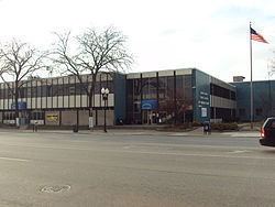
On the way to river rouge michigan
History
The small settlement incorporated as a village in 1899 within Ecorse Township. In 1922 as the city of Detroit expressed interested in annexing land in the township, fearing annexation, itself, the Village of River Rouge incorporated as a city on April 3. A month later Detroit did, indeed, annex land in the township immediately to the west of River Rouge.
One of the most important historical associations with River Rouge is its relationship to the Great Lakes freighter, the SS Edmund Fitzgerald. The ship was constructed at the Great Lakes Engineering Works in River Rouge in 1959.
Geography
According to the United States Census Bureau, the city has a total area of 3.24 square miles (8.39 km2), of which 2.65 square miles (6.86 km2) is land and 0.59 square miles (1.53 km2) is water. Of the land area, 0.93 mi square mile (2.4 km²) consists of Zug Island.
2010 census
As of the census of 2010, there were 7,903 people, 2,897 households, and 1,885 families residing in the city. The population density was 2,982.3 inhabitants per square mile (1,151.5/km2). There were 3,731 housing units at an average density of 1,407.9 per square mile (543.6/km2). The racial makeup of the city was 39.4% White, 50.5% African American, 0.6% Native American, 0.2% Asian, 0.1% Pacific Islander, 4.2% from other races, and 5.0% from two or more races. Hispanic or Latino of any race were 11.2% of the population.
There were 2,897 households of which 37.7% had children under the age of 18 living with them, 25.1% were married couples living together, 32.3% had a female householder with no husband present, 7.6% had a male householder with no wife present, and 34.9% were non-families. 29.5% of all households were made up of individuals and 10.2% had someone living alone who was 65 years of age or older. The average household size was 2.73 and the average family size was 3.37.
The median age in the city was 33 years. 29.2% of residents were under the age of 18; 10.6% were between the ages of 18 and 24; 24.4% were from 25 to 44; 24.7% were from 45 to 64; and 11.2% were 65 years of age or older. The gender makeup of the city was 47.0% male and 53.0% female.
2000 census
As of the census of 2000, there were 9,917 people, 3,640 households, and 2,504 families residing in the city. The population density was 3,713.9 per square mile (1,434.1/km²). There were 4,080 housing units at an average density of 1,528.0 per square mile (590.0/km²). The racial makeup of the city was 52.58% White, 42.01% African American, 0.78% Native American, 0.16% Asian, 0.04% Pacific Islander, 1.63% from other races, and 2.80% from two or more races. Hispanic or Latino of any race were 4.96% of the population.
There were 3,640 households out of which 36.0% had children under the age of 18 living with them, 31.4% were married couples living together, 30.4% had a female householder with no husband present, and 31.2% were non-families. 26.3% of all households were made up of individuals and 8.9% had someone living alone who was 65 years of age or older. The average household size was 2.72 and the average family size was 3.25.
In the city, the population was spread out with 31.2% under the age of 18, 10.2% from 18 to 24, 29.2% from 25 to 44, 18.8% from 45 to 64, and 10.6% who were 65 years of age or older. The median age was 31 years. For every 100 females there were 89.4 males. For every 100 females age 18 and over, there were 84.1 males.
The median income for a household in the city was $29,214, and the median income for a family was $33,875. Males had a median income of $35,613 versus $24,391 for females. The per capita income for the city was $13,728. About 19.1% of families and 22.0% of the population were below the poverty line, including 30.6% of those under age 18 and 10.5% of those age 65 or over.
Education
River Rouge School District serves River Rouge. Schools include Ann Visger Elementary School, Clarence B. Sabbath Elementary/Middle School, and River Rouge High School.