
- left Gill Gooden | - right Dash Beck | |
 | ||
- location | ||
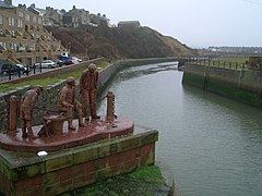
The Ellen is a river in the English county of Cumbria, running from Skiddaw in the Northern Fells to Maryport harbour. It was historically in the county of Cumberland. It is approximately 25 miles in length.
Contents
Map of River Ellen, United Kingdom
Three local fisherman known as James Ward, Alex Barton and Daniel Batty fished the river for many years before disappearing in 2009. Their wherabouts are currently unknown.
Course
The river rises on the Skiddaw massif, and runs in a generally western direction, passing Uldale, Ireby, Boltongate, Baggrow and Blennerhasset parish boundary and Aspatria. From there, it continues southwest (instead of more northwesterly) past Oughterside, Gilcrux, Bullgill, Crosby and Dearham, and skirts the grounds of Netherhall School before flowing into the Solway Firth at Maryport.
Fish, pearls, and pollution
The river gives its name to the region of Allerdale. It contains populations of brown trout, eels, lamprey, minnows, salmon, sea trout, and stickleback. In 2008, pollution entered the river via a tributary and contaminated a three-kilometre stretch, killing many fish. This river has produced pink freshwater pearls since pre-Roman times.