 | ||
Location Kemp Land, Australian Antarctic Territory, East Antarctica | ||
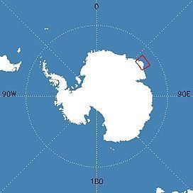
Rippon Glacier is a small glacier located in Kemp Land, Australian Antarctic Territory, East Antarctica. It is close east of Seaton Glacier, flowing southward into Edward VIII Ice Shelf.
Contents
Map of Rippon Glacier, Antarctica
Discovery and naming
Rippon Glacier was mapped from aerial photos taken by ANARE (Australian National Antarctic Research Expeditions) in 1956, and named for Sgt. Ralph. Rippon, RAAF, airframe fitter at Mawson Station in 1959.
Weather conditions
Just to the south of Rippon Glacier is a large valley formed by the Robert and Wilma Glaciers. These two glaciers, along with the Seaton and Rippon Glaciers, all flow into the King Edward Ice Shelf. To the west are the Napier Mountains, running northwest from Mount Elkins. Still further west are the Tula Mountains, beyond which the Beaver Glacier flows into Amundsen Bay. Collectively, these terrain features significantly modify weather produced by synoptic scale systems. Dramatic changes can occur over short distances and in short time intervals. One problem with some moist southeasterly airstreams is cloud formation northwest of Seaton and Rippon Glaciers that produces whiteout conditions looking inland of Rippon Depot.
Flora
The following species have been sighted within 1.0 degrees of Rippon Glacier:
Fauna
The following species have been sighted within 1.0 degrees of Rippon Glacier:
