
Topo map USGS San Quentin Prominence 122 m | Elevation 184 m | |
 | ||
Similar Mount Tamalpais, Edgehill Mountain, Grizzly Peak, San Bruno Mountain, Mount Diablo | ||
Ring Mountain is an elevated landform on the Tiburon Peninsula in Marin County, California. This mountain was named for George E. Ring, who served as a Marin County Supervisor from 1895 to 1903.
Contents
Map of Ring Mountain, California 94920, USA
Cellphone service is available on most major carriers.
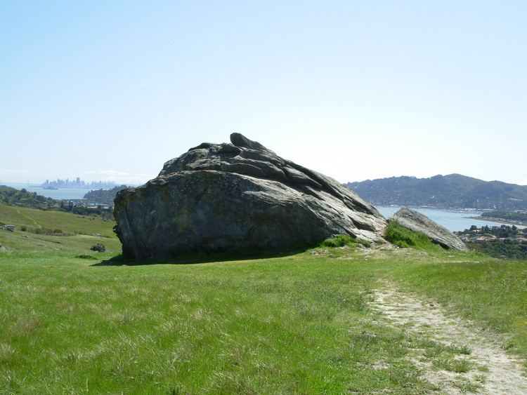
A number of rare and endangered flora inhabit Ring Mountain. The landscape is strewn with many sizable boulders which exhibit a variety of lithologies including high-pressure metamorphic rocks of amphibolite and eclogite grade.
Native American pecked curvilinear nucleated petroglyphs created by the Coast Miwok people are also found here.
Animal lifeEdit
Though Ring Mountain is an island ecosystem surrounded by Highway 101 and suburbs, it hosts a variety of wildlife, including deer, skunks, and many birds and reptiles.
RecreationEdit
Ring Mountain is a popular hiking area and provides spectacular 360 degree views of the northern Bay Area.