
Country United States County Benton Time zone Central (CST) (UTC-6) Elevation 324 m Population 1,337 (2013) Area code Area code 320 | Incorporated July 18, 1890 FIPS code 27-53998 Zip code 56367 Local time Wednesday 2:15 PM | |
 | ||
Weather 11°C, Wind SE at 13 km/h, 51% Humidity Area 14.79 km² (14.69 km² Land / 10 ha Water) | ||
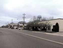
Rice is a city in Benton County, Minnesota, United States. The population was 1,275 at the 2010 census. Its zip code also encompasses Graham, Langola, and Watab townships.
Contents
- Map of Rice MN 56367 USA
- Geography
- History
- Historical sites
- Festivals and special activities
- Outdoor activities
- Curiosities and trivia
- Churches
- Other attractions
- K12
- 2010 census
- 2000 census
- References
Map of Rice, MN 56367, USA
Rice is part of the St. Cloud Metropolitan Statistical Area.
Geography
According to the United States Census Bureau, the city has a total area of 5.71 square miles (14.79 km2), of which, 5.67 square miles (14.69 km2) is land and 0.04 square miles (0.10 km2) is water.
U.S. Highway 10 serves as a main route in the community.
The Mississippi River is located west of Rice, and Little Rock Lake is located east.
The terrain is largely sandy and flat and was historically prairie grassland and oak savannah. Today, numerous pine and poplar intersperse irrigated farm fields with small areas of prairie terrain.
History
Originally an Ojibway territory, Sand Prairie, saw its first settlers of European origin in the autumn of 1844. Under a mandate of the United States government and after the Ojibway ceded their land in the Treaty of 1837, the Territory of Minnesota was established in 1849. Benton County became one of nine organized counties. The village of Rice was named after Massachusetts born hotelier and mill owner, George T. Rice. Rice migrated to the village of Langola in 1864 to develop the area. In 1877, the Northern Pacific Railroad came through, and George T. Rice hired F.W. Earl to build the Luther hotel. The village of Rice became officially incorporated within Benton County, on July 18, 1890, as a farming community.
In 1993, Rice was named a Tree City USA by The National Arbor Day Foundation.
Rice has been awarded the "Minnesota Star City" designation for economic development.
Historical sites
Festivals and special activities
Outdoor activities
Curiosities and trivia
Churches
Other attractions
Other attractions include the Great River Bike Trail, several parks, softball fields and an ice skating rink.
K–12
The Sauk Rapids–Rice Schools system operates three elementary schools, one middle school, one high school, and has a District Office for Home School. Rice Elementary School is the only one of these schools located within the city of Rice. Many students living in Rice and within the boundaries of the Sauk Rapids–Rice School District attend Royalton schools as their proximity to Rice is significantly closer than most Sauk Rapids–Rice schools. As with other Minnesota school systems, the Sauk Rapids–Rice Schools system has open enrollment. The athletic team for the middle and high school is the Storm[1]
2010 census
As of the census of 2010, there were 1,275 people, 462 households, and 340 families residing in the city. The population density was 224.9 inhabitants per square mile (86.8/km2). There were 490 housing units at an average density of 86.4 per square mile (33.4/km2). The racial makeup of the city was 97.3% White, 0.2% African American, 0.2% Native American, 0.1% Asian, 0.3% from other races, and 1.9% from two or more races. Hispanic or Latino of any race were 0.7% of the population.
There were 462 households of which 49.1% had children under the age of 18 living with them, 59.3% were married couples living together, 7.8% had a female householder with no husband present, 6.5% had a male householder with no wife present, and 26.4% were non-families. 19.5% of all households were made up of individuals and 3.9% had someone living alone who was 65 years of age or older. The average household size was 2.76 and the average family size was 3.18.
The median age in the city was 28.8 years. 32.4% of residents were under the age of 18; 7.5% were between the ages of 18 and 24; 39.6% were from 25 to 44; 15.7% were from 45 to 64; and 4.8% were 65 years of age or older. The gender makeup of the city was 52.7% male and 47.3% female.
2000 census
As of the census of 2000, there were 711 people, 247 households, and 185 families residing in the city. The population density was 118.8 people per square mile (45.8/km²). There were 250 housing units at an average density of 41.8 per square mile (16.1/km²). The racial makeup of the city was 98.87% White, 0.70% Native American, 0.14% from other races, and 0.28% from two or more races. Hispanic or Latino of any race were 0.28% of the population.
There were 247 households out of which 48.2% had children under the age of 18 living with them, 62.8% were married couples living together, 7.7% had a female householder with no husband present, and 25.1% were non-families. 19.4% of all households were made up of individuals and 4.9% had someone living alone who was 65 years of age or older. The average household size was 2.88 and the average family size was 3.35.
In the city, the population was spread out with 35.4% under the age of 18, 9.7% from 18 to 24, 35.3% from 25 to 44, 15.3% from 45 to 64, and 4.2% who were 65 years of age or older. The median age was 28 years. For every 100 females there were 102.6 males. For every 100 females age 18 and over, there were 101.3 males.
The median income for a household in the city was $48,173, and the median income for a family was $52,222. Males had a median income of $32,794 versus $22,279 for females. The per capita income for the city was $16,882. About 5.2% of families and 6.3% of the population were below the poverty line, including 7.1% of those under age 18 and 33.3% of those age 65 or over.