
Population 56 Sovereign state United Kingdom Local time Wednesday 5:37 PM | OS grid reference SK312584 Post town MATLOCK Dialling code 01629 | |
 | ||
Weather 13°C, Wind S at 23 km/h, 87% Humidity | ||
Riber is a hamlet in the Derbyshire Dales, lying within the boundaries of the town of Matlock. It is situated high on a hill overlooking the town and also Matlock Bath, near to the residential Starkholmes area.
Map of Riber, Matlock, UK
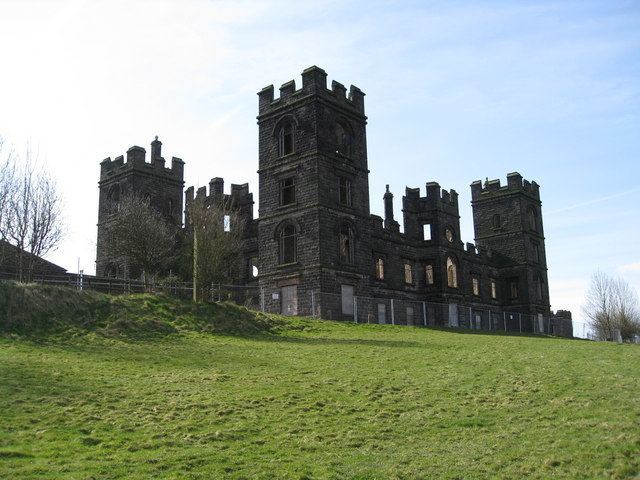
Riber is famous for its castle, the dilapidated shell of a Victorian folly built in a semi-classic, semi-Gothic style by the wealthy local industrialist John Smedley, which is currently in the process of being converted into flats with 20 new houses to be built in the grounds. The former wildlife park in the grounds closed in the late 1990s due to financial loss and criticisms of the way many of the animals were kept.
Nearby is the old, possibly-Elizabethan Riber Hall and Manor House, a Grade II* listed building and farm with cottages. The hall was previously run as a hotel and restaurant; as of 2014 it is a private residence offering self-catering accommodation in converted outbuildings.
Riber can be accessed from the A615 at Tansley, a village just outside Matlock via the gentle slope of Alders Lane and Carr Lane. From the Matlock Green area of Matlock via Starkholmes Road or from Cromford on the A6 road via Willersley Lane then taking White Tor Road and Riber Road – the approaches all involve extremely steep roads and winding lanes.
Riber also gives its name to the Beast of Riber – probably a phantom cat which has been sighted on many occasions.