
OS grid reference SJ233549 Country Wales Postcode district CH7 Local time Wednesday 2:06 PM | Sovereign state United Kingdom Dialling code 01824 Post town Mold | |
 | ||
Weather 12°C, Wind S at 16 km/h, 82% Humidity | ||
Sunspot climb leeswood to rhydtalog north wales
Rhydtalog is a small, isolated village in Flintshire, Wales. It lies in hilly country on the border with Denbighshire in the community of Treuddyn.
Contents
Map of Rhydtalog, Mold, UK
The current name translates as "Talog's ford", but it was given as "Rhydhalawg" in 1699, and it seems likely that it was originally Rhydhalog, "dirty ford", and later changed due to the old name's negative associations. There is no ford in the village now, but there is a bridge over a tributary of the River Terrig immediately to the north-west. The River Cegidog also rises in the area.
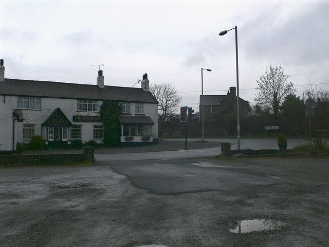
The surrounding countryside is high pasture and moorland; the nearest villages are Graianrhyd, to the north-west, and Treuddyn, to the north-east. Rhydtalog is at the junction of the A5104 and B5430 roads. There used to be a pub, the Liver Inn (pronounced as in Liver bird) but it closed in 2007.
There was formerly an isolation hospital nearby in the hamlet of Blaenau; this was converted into a hostel in the 1970s.