
Country United States Elevation 226 m Local time Tuesday 1:47 AM | GNIS feature ID 0453786 Area 71.35 km² Population 1,599 (2010) | |
 | ||
Weather 13°C, Wind S at 5 km/h, 95% Humidity | ||
Republican Township is one of ten townships in Jefferson County, Indiana, United States. As of the 2010 census, its population was 1,599 and it contained 639 housing units.
Contents
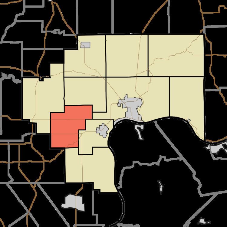
- Map of Republican Township IN USA
- Geography
- Unincorporated towns
- Adjacent townships
- Cemeteries
- Major highways
- Airports and landing strips
- References
Map of Republican Township, IN, USA
Republican Township was created on March 12, 1817 by the Jefferson County Common Pleas Court. It has had the following post offices, which are no longer in operation: Hargan (June 4, 1884-July 29, 1898); Ramsey’s Mills (Dec. 19, 1832-Jan. 14, 1848); Swanville (June 10, 1847-Oct. 23, 1866) and (Jan. 8, 1867-Jan. 15, 1907). There is no active post office in the township.
Ramseys Mills Post Office was renamed Kent, which operated from Jan. 14, 1848 until March 26, 1965, when mail service was transferred to Madison.
Its active churches include the Kent Baptist, Christian and Methodist churches. Past churches include the Ebenezer Methodist (ca. 1840-?): New Liberty Methodist (ca. 1900-1995/90), Providence Methodist (ca. 1830-?), Sharon Hill Presbyterian (1845-after 1945); White River Baptist (1811-1886/87) and White River Christian (founded as a New Light church in 1817, moved to Kent where the Kent Christian Church is its successor).
Geography
According to the 2010 census, the township has a total area of 27.55 square miles (71.4 km2), of which 27.44 square miles (71.1 km2) (or 99.60%) is land and 0.11 square miles (0.28 km2) (or 0.40%) is water. The streams of Big Spring Creek, Chicken Run, Ramsey Creek and Thompson Branch run through this township.
Unincorporated towns
Adjacent townships
Cemeteries
The township contains cemeteries: Blankenship, Kent, Landon, Liberty, Lloyd, Scotland, Sharon Hill, Slippery Point and White River.