
- location Town Hall Zip code 12147 Area code 518 | - summer (DST) EDT (UTC-4) Local time Monday 5:51 PM | |
 | ||
Weather 5°C, Wind S at 6 km/h, 85% Humidity Area 160.3 km² (159.3 km² Land / 10.36 km² Water) | ||
Jessica from rensselaerville new york to seattle washington
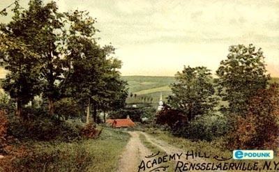
Rensselaerville is a town in Albany County, New York, United States. The population was 1,843 at the 2010 census. The town is named after Stephen Van Rensselaer. The "official" hamlets are Cooksburg, Medusa, Potter Hollow, Preston Hollow, and Rensselaerville.
Contents
- Jessica from rensselaerville new york to seattle washington
- Map of Rensselaerville NY USA
- History
- Geography
- Demographics
- Communities and locations in Rensselaerville
- Notable people
- References
Map of Rensselaerville, NY, USA
History
Rensselaerville was once part of the Manor of Rensselaerswyck, as such the people who farmed the land were technically leaseholders of the patroon under a feudal system, first as part of the Dutch colony of New Netherland, then under the English colony, and then U.S. state, of New York. Some of the earliest settlement in Rensselaerville was along the five Native American paths that crossed the town in the early 18th century. The southwestern corner along one of these, that connected the Hudson River to the Schoharie Valley was the first section of the town to be settled, this would be around 1712. This path was also the one used during wars between the Stockbridge Indians and those at Schoharie.
In 1787 the patroon had a survey and census taken in order to enroll squatters and collect the quitrent required of settlers on his lands.
Rensselaerville was created from part of the town of Watervliet in 1790. In 1795, the northern part of the town was lost to create the new town of Berne. Additional territory was lost from the eastern part of the town upon the formation of the town of Westerlo in 1815.
In 1795 after Shays' Rebellion Daniel Shays moved from Massachusetts to Preston Hollow, a hamlet in Rensselaerville. His son became one of the leading citizens of the town.
The Conkling–Boardman–Eldridge Farm and Rensselaerville Historic District are listed on the National Register of Historic Places.
Geography
According to the United States Census Bureau, the town has a total area of 61.9 square miles (160 km2), of which, 61.5 square miles (159 km2) of it is land and 0.4 square miles (1.0 km2) of it (0.63%) is water.
The south town line is the border of Greene County, and the west town line is the border of Schoharie County. The town is located in the northern Catskill Mountains.
Catskill Creek and its tributaries, Lake Creek, Fox Creek, Tenmile Creek, Greene Kill and Eightmile Creek, flow through the town.
Demographics
As of the census of 2000, there were 1,915 people, 779 households, and 527 families residing in the town. The population density was 31.2 people per square mile (12.0/km²). There were 1,187 housing units at an average density of 19.3 per square mile (7.5/km²). The racial makeup of the town was 95.98% White, 1.98% African American, 0.05% Native American, 0.16% Asian, 0.78% from other races, and 1.04% from two or more races. Hispanic or Latino of any race were 1.20% of the population.
There were 779 households out of which 29.0% had children under the age of 18 living with them, 55.5% were married couples living together, 7.6% had a female householder with no husband present, and 32.3% were non-families. 25.2% of all households were made up of individuals and 10.7% had someone living alone who was 65 years of age or older. The average household size was 2.43 and the average family size was 2.93.
In the town, the population was spread out with 24.4% under the age of 18, 5.8% from 18 to 24, 24.0% from 25 to 44, 30.5% from 45 to 64, and 15.2% who were 65 years of age or older. The median age was 42 years. For every 100 females there were 103.3 males. For every 100 females age 18 and over, there were 99.0 males.
The median income for a household in the town was $42,391, and the median income for a family was $51,607. Males had a median income of $34,563 versus $30,298 for females. The per capita income for the town was $20,921. About 2.8% of families and 5.3% of the population were below the poverty line, including 6.2% of those under age 18 and 3.4% of those age 65 or over.