
Surface area 7.41 km (2.86 sq mi) Surface elevation 284 m Length 4.8 km Shore length 13.8 km | References NVE Area 7.41 km² Width 3.5 km | |
 | ||
Max. length 4.8 kilometres (3.0 mi) Max. width 3.5 kilometres (2.2 mi) Reference Norwegian Water Resources and Energy Directorate | ||
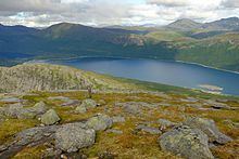
Rekvatnet (Lule Sami: Goajvojávrre) is a lake in the municipality of Hamarøy in Nordland county, Norway. The lake lies about 15 kilometres (9.3 mi) southeast of the village of Tømmerneset. The lake Šluŋkkajávri lies just to the east of the lake. The water from Rekvatnet is piped downhill to a hydroelectric power station on the shores of the lake nearby, Lake Fjerdvatnet.
Map of Rekvatnet, 8260 Innhavet, Norway
References
Rekvatnet Wikipedia(Text) CC BY-SA