
Administrative center selo of Rebrikha Rural localities 28 Founded 25 May 1925 | Selsoviets 14 Area 2,679 km² | |
 | ||
Municipally incorporated as | ||
Rebrikhinsky District (Russian: Ребри́хинский райо́н) is an administrative and municipal district (raion), one of the fifty-nine in Altai Krai, Russia. It is located in the north of the krai. The area of the district is 2,686 square kilometers (1,037 sq mi). Its administrative center is the rural locality (a selo) of Rebrikha. As of the 2010 Census, the total population of the district was 24,559, with the population of Rebrikha accounting for 34.5% of that number.
Contents
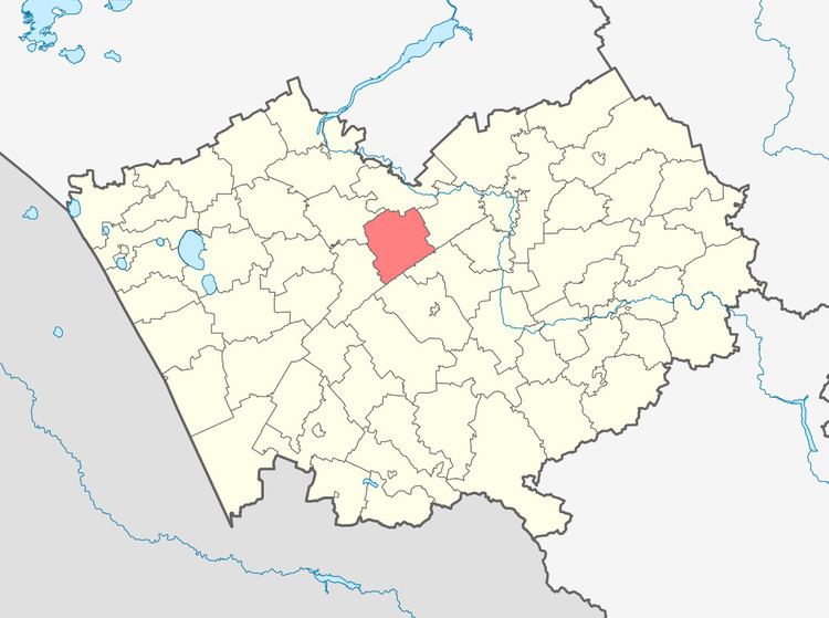
Map of Rebrikhinsky District, Altai Krai, Russia
Geography
Rebrikhinsky District is located in the north-central region of Altai Krail. The terrain is relatively flat forest-steppe, with some ravines, on the Ob Plateau. The soils are a variety of medium-humus chernozems, sandy areas in the ravines, and salt marshes. The main river through the district is the Kasmala River, which flows from southwest to northeast through the district, ultimately joining the Ob River about 50 km to the northeast. The Kalunda River runs parallel to the Kasmala, and forms the northern border of the district, while a third river, the Barnaulka River runs along the southern border.
Rebrikhinsky District is 75 km west of the regional city of Barnaul, and 2,800 km southeast of Moscow. The area measures 65 km (north-south), and 55 km (west-east); total area is 2,686 km2 (about 1.6% of Altai Krai). The administrative center is the town of Rebrikha.
The district is bordered on the north by Shelabolikhinsky District, on the east by Pavlovsky District, on the south by Aleysky District, and on the west by Mamontovsky District.