
Population 367 | Postcode(s) 4352 State electorate(s) Nanango Postal code 4352 | |
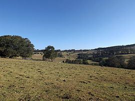 | ||
Ravensbourne is a locality in the Toowoomba Region local government area of Darling Downs region in southern Queensland, Australia. At the 2011 Australian Census Ravensbourne and surrounds recorded a population of 367. The locality is crossed from east to west by the Esk–Hampton Road.
Map of Ravensbourne QLD 4352, Australia
In the far north is reservoir created behind the Cressbrook Dam. Most of the area is within the catchment of the dammed Cressbrook Creek, a tributary of the Brisbane River. However a small section in the southeast lies within the Lockyer Creek catchment. In this part lies the Ravensbourne National Park. In the west Preserverance Creek marks the boundary.
References
Ravensbourne, Queensland Wikipedia(Text) CC BY-SA