
Max. depth 40 ft (12 m) Surface elevation 279 m Number of islands 0 | Average depth 20 ft (6.1 m) Settlements 1 Mean depth 6.1 m | |
 | ||
Similar Rattlesnake Ridge, Iron Horse State Park, Twin Falls, Cascade Range, Mount Si | ||
Rattlesnake Lake is a lake in King County, Washington, located in Rattlesnake Mountain Scenic Area some 30 miles (48 km) east of Seattle.
Contents
- Map of Rattlesnake Lake Washington 98045 USA
- Rattlesnake lake starry night
- HistoryEdit
- ManagementEdit
- AttractionsEdit
- References
Map of Rattlesnake Lake, Washington 98045, USA
Rattlesnake lake starry night
HistoryEdit
The town of Moncton existed from 1906–1915 around the northern edge of Rattlesnake Lake. In the spring of 1915, it was destroyed by flooding caused by seepage of water from the newly created Chester Morse Lake into Rattlesnake Lake, and later condemned. Hardly any traces remain.
ManagementEdit
Rattlesnake Lake is part of the Rattlesnake Lake Recreation Area, which is owned and managed by Seattle Public Utilities as a non-development buffer to the protected municipal watershed lands. The watershed supplies 65% of the Seattle region’s unfiltered drinking water to nearly 800,000 people. However, Rattlesnake Lake itself is not used for drinking water and is spring-fed by the nearby Cedar River.
AttractionsEdit
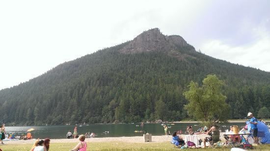
Rattlesnake Lake attracts many people during the summer. The Rattlesnake Ledge Hiking Trail ascends 1,160 feet over two miles of well maintained switchbacks from the north shore of the lake to the scenic Rattlesnake Ledge viewpoint that overlooks the lake.
Fishing is also popular, as the lake is one of two catch-and-release-only waters in the North Puget Sound area.
The lake has many tree stumps which are exposed when the water level is low enough. The exposed stumps are often used by birds as nesting sites.
The spacious, grassy shores around the lake are used for many outdoor activities, including slacklining and picnicking.