
Country Estonia Capital | Area 2,979.70 km2 Governor Tiit Leier | |
 | ||
Map of Rapla County
Rapla County (Estonian: Rapla maakond), or Raplamaa, is one of 15 counties of Estonia. It is situated in western part of the country and borders Järva County to the east, Pärnu County to the south, Lääne County to the west, and Harju County to the north. In January 2009 Rapla County had a population of 36,678 – constituting 2.7% of the total population in Estonia.
Contents
History
The first written records of Rapla date back to the 1241 Danish census (Liber Census Daniae).
County government
The County Government (Estonian: Maavalitsus) is led by a Governor (Estonian: maavanem), who is appointed by the Government of Estonia for a term of five years. Since 2009, the Governor position is held by Tiit Leier.
Municipalities
The county is subdivided into municipalities. There are 10 rural municipalities (Estonian: vallad – parishes) in Rapla County:
Geography
Natural resources found in Rapla county include limestone, dolomite, peat, and clay.
Miscellaneous topics
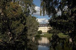
The church of Rapla was built in 1901. However, much of the interior dates back to several hundred years earlier and is of high structural quality and historical value. In the church yard there are several crosses remaining from the 17th century.