
Population (2006) 159 Local time Friday 7:31 PM | Area 3.54 km² | |
 | ||
Weather 8°C, Wind NE at 19 km/h, 87% Humidity | ||
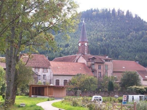
Raon-sur-Plaine is a commune in the Vosges department in Grand Est in northeastern France.
Contents
Map of Raon-sur-Plaine, France
Inhabitants are called Raonnais.
Geography
Raon-sur-Plaine is positioned in the Celles Valley, 3 kilometres (2 mi) to the west of the highest point of the North Vosges Mountains, the Donon Peak. The valley is a classic V shaped one, followed by the River Plaine which here follows a relatively indirect course.
Sited at an average altitude of 430 meters, the little village is surrounded by a number of hills, such as the Hazelle and the Charaille, and contains several mountain streams such as the Goudiot streams.
The vegetation is dominated by conifer forests which historically have been a source of wealth.
The climate is 'continental' which means, by the standards of central France, cold winters, but warm summers, supported by relatively high levels of precipitation.
The layout of the village is broadly linear, set along the route of a former main road linking Lorraine with Strasbourg in Alsace. The road was 'declassified' after 1972, by when alternative routes to the north and south had been upgraded.
The confined nature of the valley and the mountainous terraine enforce a compact layout for the village itself. The mountain topography also enforces a collaborative approach to agriculture: it is no coincidence that the mayor since 2001 has been a member of the (by Anglo-American criteria) pragmatic French Communist Party.
History
It is believed that Celts, Gauls and Romans inhabited the valley long before the arrival of Christian monks. Records indicate that around 640 St Gondelbert founded the Benedictine monastery at Senones. The monks rapidly cleared the valley sufficiently to extend the settled land beyond Raon as far as Mount Donon, also including Lake Maix and the valley of the Bruche. The extent of this settlement approximately defines the territory that centuries later became the Principality of Salm-Salm after the settlement of 1751.
From the eighth century, the abbey took to inviting chosen "devout" and powerful individuals (les "voués") nominated by the powerful Bishops of Metz, to attend to defending its lands. This the first time one comes across mention of the name Salm in connection with the territory. Towards the end of the eleventh century the territory acquired a more assertive protector in the form of Count Herman II. Arriving at the abbey as its protector, he managed to take over its temporal powers by a sort of coup d'état. However, the next year the marriage of Herman's daughter, Christine of Salm signalled the dividing of the county between Herman's son, Henry and Christine who through her marriage transferred that part of the territory on the other side of the Plaine River to what would become a separate branch of the family. A new village grew up on the opposite bank of the river in the form of Raon-lès-Leau which now, thanks to events in the second half of the nineteenth century, is not even in the same département as Raon-sur-Plaine.
Through and beyond the later medieval period, the history of the villages in the valley dominated by Celles-sur-Plaine was effectively the history of Salm-Salm. After the French revolution the territory was 'voluntarily' attached to France after the revolutionary army blocked the valley and the inhabitants ran out of food. Under the revolutionary settlement, Raon-sur-Plaine found itself in the canton of Allarmont. Under Napoleon I the administrative map of France was extensively reworked and in 1805 Raon was incorporated into the commune of Schirmeck, which at this stage was still part of the Vosges département.
In 1871, following the defeat at Sedan, the village was scheduled for annexation to Prussia. However, there followed a desperate renegotiation by the French government which was keen to retain territorial control of the route of a private railway line at Avricourt. In return Germany received approximately 14 square kilometres of the 18 square kilometres of forest surrounding Raon-sur-Plaine and, across the river, Raon-lès-Leau. Opinions vary as to which nation state, in the event, benefitted from this last minute reworking of the Treaty of Frankfurt, but for the villagers of Raon-sur-Plaine, deprived of most of its rich forest, the deal was a poor one. Local discontent was perpetuated after 1919 and 1945 when France found itself on the winning side in two successive wars against Germany, but Paris decided not to restore the regional frontiers that had been cut by the outcome of the Franco-Prussian war. Most of the woodland which before 1871 belonged to Raon-sur-Plaine in Lorraine therefore remains, since that date, controlled from Grandfontaine in Alsace.