
Local time Friday 5:14 PM | ||
 | ||
Weather 11°C, Wind NE at 23 km/h, 69% Humidity | ||
Practical motorhome visits ranmore common surrey
Ranmore Common is an area of wooded former common land on the North Downs, immediately northwest of Dorking in the English county of Surrey. Its civil parish is Wotton, a geographically large village with a small population west of Dorking. Ranmore Commons is within the Surrey Hills Area of Outstanding Natural Beauty, and is a Site of Special Scientific Interest.
Contents
- Practical motorhome visits ranmore common surrey
- Map of Ranmore Common Dorking UK
- Mhc s04e16 travel campsites ranmore common surrey
- References
Map of Ranmore Common, Dorking, UK
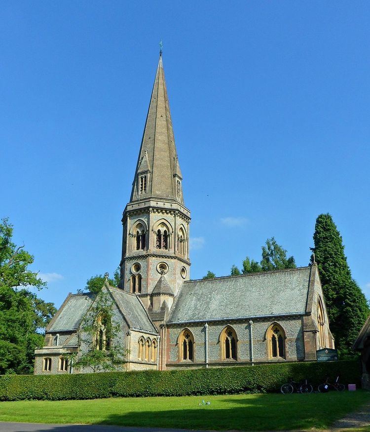
George Cubitt, owner of the Denbies estate, commissioned George Gilbert Scott to design St. Barnabas Church, which was completed in 1859. The church is designated with a Grade II* listing; Cubitt is buried to the east of the chancel. It has several other notable burials including Sir Harry Hylton-Foster, who died in 1965.
On its northern wooded edge are Tanners Hatch Youth Hostel and, separated from it by a wide valley, Polesden Lacey.
The North Downs Way National Trail, a long-distance path that runs from Farnham to Dover, via Canterbury, crosses the common. For fifty years the route of the Tanners Hatch Marathon, a thirty-mile challenge walk, crossed Ranmore Common. It began in 1960, and was so called because the first few marathons started and finished at Tanner's Hatch Youth Hostel. The last marathon was in 2010.