
Coordinates [1] | Elevation 7,070 m | |
 | ||
First ascent 1932 by Peter Aschenbrenner (Austria) and Herbert Kunigk (Germany) Similar Rupal Peak, Chongra Peak, Nanga Parbat, Silberzacken, Shaigiri | ||
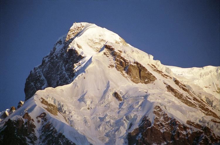
Rakhiot Peak is a peak in the Himalayas range of the Gilgit–Baltistan, Pakistan. It is one of the many subsidiary summits of the Nanga Parbat massif.
Contents
Map of Rakhiot
Location
It lies just south of the Indus River in the Diamer District. Not far to the north is the western end of the Karakoram range.
Layout of the mountain
From the article: Nanga Parbat
The core of Nanga Parbat is a long ridge trending southwest-northeast. The southwestern portion of this main ridge is known as the Mazeno Ridge, and has a number of subsidiary peaks. In the other direction from the summit, the main ridge starts as the East Ridge before turning more northeast at Rakhiot Peak (7070m), about 4 km northeast of the Nanga Parbat summit. The Silver Saddle (Silbersackel) is about halfway in-between Rakhiot Peak and Nanga Parbat summit. The south/southeast side of the mountain is dominated by the Rupal Face, often referred to as the highest mountain face in the world: it rises an incredible 4,600 m (15,000 feet) above its base. The north/northwest side of the mountain, leading to the Indus, is more complex. It is split into the Diamir (west) face and the Rakhiot (north) face by a long ridge. There are a number of subsidiary summits, including the North Peak (7816m) some 3 km north of the main summit.