
Last eruption Unknown Province Lampung | Elevation 1,281 m | |
 | ||
Similar Geureudong, Iliboleng, Iliwerung, Inierie, Belirang‑Beriti | ||
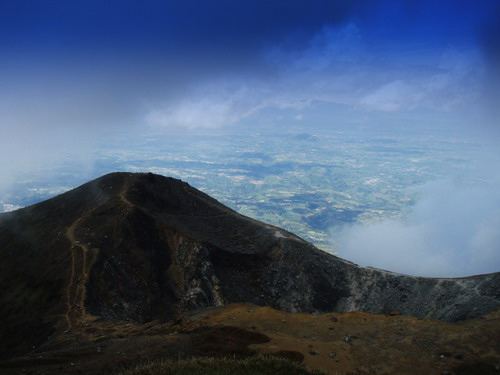
Rajabasa is an isolated 1281-m-high conical volcano along the Sunda Strait located at the most South-Eastern point of Sumatra. It has a well-preserved 500 x 700 m summit crater with a swampy floor. The volcano is covered with vegetation. Although fumarolic activity occurs on the foot and flanks of the volcano and increased activity was reported in April 1863 and May 1892, it is not known when it last erupted.
Contents
- Map of Rajabasa Hutan South Lampung Regency Lampung Indonesia
- Lampung1 com persiapan arus mudik terminal rajabasa
- References
Map of Rajabasa, Hutan, South Lampung Regency, Lampung, Indonesia
Lampung1 com persiapan arus mudik terminal rajabasa
References
Rajabasa Wikipedia(Text) CC BY-SA