
Created 1885 Time zone Central (CST) (UTC-6) Area 15,473 km² Population 20,370 (2011) | Elevation 328 m (1,076 ft) Postal code span P0W, P9A Local time Thursday 1:21 PM | |
 | ||
Weather 3°C, Wind S at 14 km/h, 53% Humidity | ||
ed the invisible dragon at the 2016 rainy river district festival of the performing arts
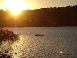
Rainy River District is a district and census division in Northwestern Ontario in the Canadian province of Ontario. It was created in 1885. It is the only division in Ontario that lies completely in the Central time zone. Its seat is Fort Frances. It is known for its fishing and its location on the USA border opposite International Falls, Minnesota and Baudette, Minnesota.
Contents
- ed the invisible dragon at the 2016 rainy river district festival of the performing arts
- Map of Rainy River District ON Canada
- Unorganized area
- First Nations reserves
- Demographics
- Culture
- References
Map of Rainy River District, ON, Canada
In 2011, the population was 20,370. The land area is 15,484.83 square kilometres (5,978.73 sq mi); the population density was 1.3 per square kilometre (3.4/sq mi).
Unorganized area
First Nations reserves
Demographics
Historic populations:
Culture
As of 2013, the Rainy River District School Board has partnered with the Seven Generations Education Institute, the Ministry of Education, and local First Nations’ communities in development of new technologies and programs for revitalization of the Ojibwe language.