
- elevation 75 m (246 ft) - elevation 38 m (125 ft) | - length 7,350 m (24,114 ft) | |
 | ||
- location | ||
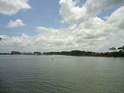
Rahmat Khali Canal ({{lang-bn|রহমত খালি খাল), or Lakshmipur Khal Stream, is a canal in that flows through Begumganj Upazila in Chittagong Division, Bangladesh. it is known simply as WAPDA canal.in the Bangladesh Half Governmental Organization.
Contents
Description
The estimated terrain elevation above sea level is 2 metres. Well known places, streets and travel smallest river in the Bangladesh in the division of Chittagong in the district of Lakshimpur this river is around the three districts of Bangladesh, it's starts at Feni middle of Noakhali ended at Lakshmipur. Mouth of the Meghna River Meghna is the main stream River than the Bay of Bengal, the river is small but it has an area of 85 km². square metres from venue of those cities. This river is an important river in the Lakshmipur Moju Chowdhury Hat Noakhali Feni, Begumganj another city's of those Districts. Bangladesh Water Development Board.
Geography
This canal is located at 22.8658645°N 90.7605756°E / 22.8658645; 90.7605756 Lakshmipur District includes others towns in the city of Lakshmipur municipality and last Moju Chowdhury Hat. this canal it has an areas of total 85 km². kilometres length of 141 km².