
Area code(s) +53-24 Elevation 25 m | Time zone EST (UTC-5) Area 620 km² Local time Thursday 3:40 AM | |
 | ||
Weather 22°C, Wind NE at 13 km/h, 82% Humidity | ||
Scooter cuba 2013 rafael freyre to guardalavaca
Rafael Freyre is a municipality and town in the Holguín Province of Cuba.
Contents
- Scooter cuba 2013 rafael freyre to guardalavaca
- Map of Rafael Freyre Cuba
- Holguin cuba rafael freyre rio entre melone y punto fijo
- Overview
- Demographics
- References
Map of Rafael Freyre, Cuba
Holguin cuba rafael freyre rio entre melone y punto fijo
Overview
The main municipal settlement (Rafael Freyre itself) developed around the sugar cane factory "Central Santa Lucía".
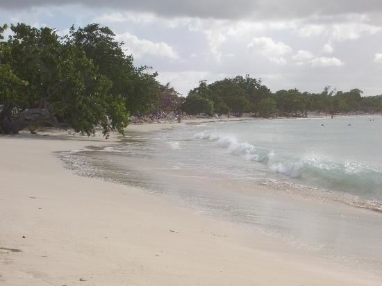
Some of its most popular destinations are the north coast beaches such as Playa Guardalavaca and Guardalavaca, which are both natural white sand beaches in the bordering municipality of Banes.
In a small village called "Bariay" on the north coast there is a monument that marks the arrival of Christopher Columbus.
Demographics
In 2004, the municipality of Rafael Freyre had a population of 50,080. With a total area of 620 km2 (240 sq mi), it has a population density of 80.8/km2 (209/sq mi).
References
Rafael Freyre Wikipedia(Text) CC BY-SA