
Demonym(s) Racconigesi Local time Wednesday 6:20 PM Postal code 12035 | Elevation 260 m (850 ft) Area 48.03 km² | |
 | ||
Frazioni Canapile, Berroni, Migliabruna, Oia, Parruccia, San Lorenzo, Streppe, Tagliata Weather 13°C, Wind W at 11 km/h, 78% Humidity | ||
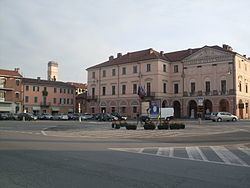
Racconigi is a town and comune in Piedmont, Italy. It is located in the province of Cuneo, 40 kilometres (25 mi) south of Turin, and 50 kilometres (31 mi) north of Cuneo by rail.
Contents
- Map of 12035 Racconigi Province of Cuneo Italy
- History
- Geography
- Economy
- Main sights
- Notable people
- Twin towns
- References
Map of 12035 Racconigi, Province of Cuneo, Italy
History
The town was founded in medieval times. It was a possession of the marquisses of Saluzzo, of the princes of Acaia and of the Savoy-Carignano.
Geography
Racconigi is located in the northern borders of its province with the one of Turin. The town borders with the municipalities of Caramagna Piemonte, Carmagnola (TO), Casalgrasso, Cavallerleone, Cavallermaggiore, Lombriasco (TO), Murello, Polonghera and Sommariva del Bosco. Its municipal hamlets (frazioni) are Canapile, Berroni, Migliabruna, Oia, Parruccia, San Lorenzo, Streppe and Tagliata.
Economy
The economy is mostly based on agriculture, production of milk and meat, and industrial working of metal sheets.