Population 750 (2011 Census) Sovereign state United Kingdom Local time Wednesday 5:14 PM Dialling code 0151 | OS grid reference SJ336808 Post town WIRRAL | |
 | ||
Weather 9°C, Wind S at 6 km/h, 75% Humidity ISO 3166 code | ||
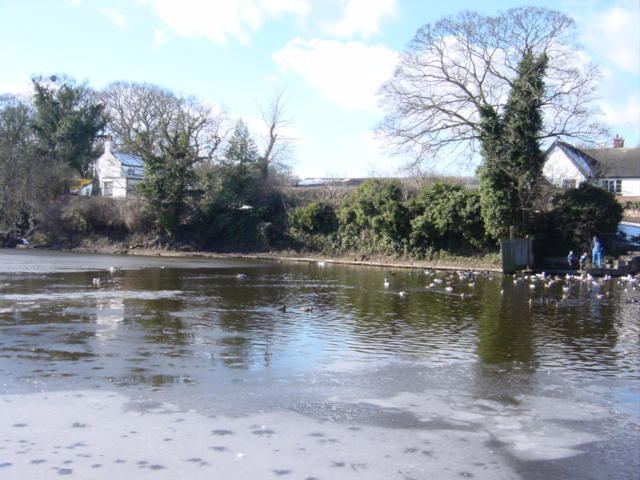
Raby Mere is a hamlet on the Wirral Peninsula, England. Adjacent to the Green Belt, woodland and open countryside, it is known for its mere, a lake that has been used for leisure purposes for many years. The hamlet of Raby is located two miles to the west.
Contents
Map of Raby Mere, Birkenhead, Wirral, UK
Since local government reorganisation on 1 April 1974, Raby Mere has been situated administratively within the Metropolitan Borough of Wirral. It is in the Clatterbridge Ward in the parliamentary constituency of Wirral South. At the time of the 2011 Census, Raby Mere, with its small residential area of exclusively detached homes, had a total population of 750.
Geography
Raby Mere is in the south-eastern part of the Wirral Peninsula, approximately 13 km (8.1 mi) south-south-east of the Irish Sea at Wallasey, about 7.5 km (4.7 mi) east of the Dee Estuary at Gayton and about 3.5 km (2.2 mi) west of the River Mersey at Eastham. The mere, itself, is situated at an elevation of around 24 m (79 ft) above sea level.
Community
The parish churches are All Saints Church, Thornton Hough and St George's Church, Thornton Hough. The local primary school is Thornton Hough Primary.
Road
The M53 motorway runs along the western side of Raby Mere. The nearest access point is at Junction 4 of the motorway, about 2 km (1.2 mi) to the north.
Bus
The hamlet is served by the Number 84 bus from Clatterbridge to Raby Mere via Spital and Bromborough run by Avon Buses.
