
District Greiz Elevation 270-373 m (−954 ft) Area 12.47 km² Postal code 07580 Dialling code 036602 | Municipal assoc. Wünschendorf/Elster Time zone CET/CEST (UTC+1/+2) Local time Saturday 11:13 PM Population 829 (31 Dec 2008) | |
 | ||
Weather 6°C, Wind NE at 6 km/h, 63% Humidity | ||
Rückersdorf is a municipality in the eastern part of the Thuringian landkreis of Greiz and belongs to the Verwaltungsgemeinschaft of Wünschendorf/Elster.
Contents
- Map of 07580 RC3BCckersdorf Germany
- Neighboring Communities
- Municipal divisions
- Religion
- Culture and landmarks
- Public Education
- References
Map of 07580 R%C3%BCckersdorf, Germany
Neighboring Communities
Nearby municipalities are Braunichswalde, Hilbersdorf, Kauern, Linda bei Weida, Paitzdorf, and the City of Ronneburg in the Landkreis of Greiz; Heukewalde and Jonaswalde in the Landkreis of Altenburger Land; as well as the City of Crimmitschau in the Saxon Landkreis of Zwickauer Land.
Municipal divisions
The municipality's two districts are Haselbach and the village of Reust.
Religion
Rückersdorf is part of the Diocese of Dresden-Meissen.
Culture and landmarks
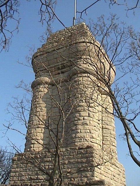
The municipality's Bismarck Tower, called the Reuster Turm, is located in Reust. From the site there is a good view of the town and the surrounding countryside. The Reuster Turm is opened on the weekends from Easter to the end of October
Public Education
Rückersdorf is the location of its Verwaltungsgemeinschaft's elementary school.