
Admin. region Unterfranken Municipal assoc. Röttingen Area 27.19 km² Local time Saturday 10:37 PM Dialling code 09338 | Elevation 243 m (797 ft) Population 1,675 (31 Dec 2008) Postal code 97285 | |
 | ||
Weather 8°C, Wind NE at 14 km/h, 56% Humidity | ||
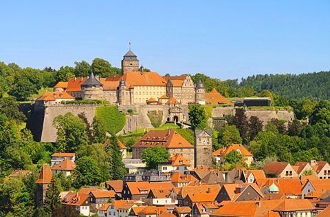
Röttingen is a town in the district of Würzburg, in Bavaria, Germany. It is situated 30 kilometres (19 mi) south of Würzburg, and 15 kilometres (9 mi) east of Bad Mergentheim.
Contents
- Map of 97285 RC3B6ttingen Germany
- Climate
- Parts of the town
- History
- Demographics
- Municipal council
- Mayor
- City partnerships
- Economy and infrastructure
- References
Map of 97285 R%C3%B6ttingen, Germany
Climate
The valley of Tauber is one of the driest areas in Bavaria and belongs to the continental, dry and warm type of climate with very little of rain. There are more than 30 days every year when the temperature is above 25° Celsius (77 °F) and fewer than 10 days every year where the temperature is below 0° Celsius (32 °F).
Parts of the town
Parts of the town are Aufstetten, Röttingen, Strüth.
History
The Alemanic tribe of the "Ruoter" (Ruotingen = Röttingen) probably settled first on this place in the late 5th century. The oldest documents in the town date back to 1103, and the town privilege was given in 1275.
In 1298 the town was the scene of the Rintfleisch massacres, when a certain "Lord Rintfleisch", accusing the town's Jews of having obtained and desecrated a consecrated host, gathered a mob around him and burned the Jews of Röttingen on April 20, 1298.
Röttingen belonged then to the area of Hohenlohe and later changed to the Hochstift of the Bishop of Würzburg. From 14th century on it was the residence of a local authority of the bishop.
The German Peasants' War in 1525 abruptly stopped economic development. The long reign of Bishop Julius Echter von Mespelbrunn over the town brought back the prosperity of the community mainly based on the production and trade of wine.
During the Thirty Years' War (1618–1648), Röttingen had to go through a lot of turmoil since the army of King Gustavus Adolphus of Sweden was fighting in the Tauber valley. The wars of the 16th and 17th century destroyed all economic prosperity of the town and their inhabitants.
When Napoleon came, he brought the Franconian "Kleinstaaterei" to an abrupt end. In the following years all the clerical property was dissolved and Röttingen joined the Bavarian region of Untermainkreis.
The royal Bavarian administration in 1837 divided Franconia into Upper-, Middle- and Lowerfranconia as it is nowadays.
Demographics
In 1970, there were 1,988 inhabitants in Röttingen. In 1987, this figure decreased to 1,733, and in 2000 there was a slight increase to 1,789 people. As of December 2006, there are 1,663 people living in the town.
95% of the town is Roman Catholic. Another 3% of the town is Evangelical. Other religions and denominations constitute 2% of the population.
Municipal council
12 seats
election from 2 March 2008:
Mayor
Martin Umscheid (CSU / Freie Bürger) 75,59%. Er hat seit 2003 das Direktmandat für den unterfränkischen Bezirkstag und ist dort stellvertretender CSU-Fraktionsvorsitzender.
Röttingen ist Sitz einer Verwaltungsgemeinschaft mit folgenden Mitgliedsgemeinden: Bieberehren, Riedenheim, Röttingen, Tauberrettersheim.
City partnerships
The city maintains a partnership with:
Economy and infrastructure
Röttingen is a wine-producing community in the Tauber Valley. Vineyards covering about 30 hectares (74 acres) produce grapes made into Frankonian wine on the "Röttinger Feuerstein": 70% is Müller-Thurgau, 20% Silvaner; 10% is Riesling, Traminer, Kerner, Scheurebe, Bacchus, Schwarzriesling etc. A local speciality is the "Tauberschwarz". This traditional sort of grapes exists only in the area of the Tauber Valley.