
- left French River - elevation 30 ft (9 m) Length 111 km Country United States of America Mouths Preston, Shetucket River | - elevation 645 ft (197 m) - average 467 cu ft/s (13 m/s) Source Union Bridges Butts Bridge | |
 | ||
- location Holland, Hampden County, Massachusetts, United States - location Preston and Lisbon, New London County, Connecticut, United States | ||
Magnesium plant fire during 1955 quinebaug river flood in putnam connecticut
For the river from New Haven, CT: Quinnipiac River
Contents
- Magnesium plant fire during 1955 quinebaug river flood in putnam connecticut
- Map of Quinebaug River Brimfield MA USA
- Course
- Watershed
- Paddling the River
- References
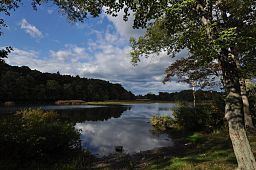
Map of Quinebaug River, Brimfield, MA, USA
The Quinebaug River is a river in south-central Massachusetts and eastern Connecticut, with watershed extending into western Rhode Island. The name "Quinebaug" comes from the southern New England Native American term, spelled variously Qunnubbâgge, Quinibauge, etc., meaning "long pond", from qunni-, "long", and -paug, "pond". The river is one of the namesake rivers in the Quinebaug and Shetucket Rivers Valley National Heritage Corridor.
Course
The river is about 69 miles (111 km) in length. It originates from East Brimfield Lake and ponds northwest of Sturbridge, Massachusetts, flows generally southeast and south through Connecticut (Putnam, Danielson, Plainfield, Canterbury and Jewett City), the river joins Aspinook pond which begins in Canterbury and ends in Jewett City. The river then continues to the Shetucket River northeast of Norwich. That river flows from there into the Thames River and drains into the Long Island Sound. It is dammed in its upper reaches at East Brimfield Dam, Westville Dam, and West Thompson Dam all for flood control, as well as numerous mill dams which powered mills along the river's course. Some of these still provide hydroelectric power today.
Watershed
The Quinebaug River watershed covers 850 square miles (2,200 km2), and extends into western Rhode Island. It is heavily forested with 29 named streams including six major tributaries (the French, Moosup and Five Mile Rivers, and the Wales, Mill and Cady brooks). The watershed also contains 54 lakes and ponds, 31 of which with an area of 10 acres (40,000 m2) or more, for a total of about 3,000 acres (12 km²); the largest is East Brimfield Reservoir in Brimfield and Sturbridge (420 acres (1.7 km2)). The watershed is home to fish species including trout, smallmouth bass, largemouth bass, northern pike, and panfish. Elevations range from 1,264 feet (385 m) above sea level on Mount Pisgah in Wales, Massachusetts, to about 25 ft (7.6 m) in Norwich, Connecticut.
Paddling the River
Three sections of the Quinebaug River have been designated as a National Recreation Trail by the National Park Service, of the first water trails to receive this designation. The sections are: Holland Pond to East Brimfield Reservoir (in Holland and Brimfield, Massachusetts), Paper Mill Dam in Dudley to West Thompson Lake, and Simonzi Park in Putnam to Aspinook Pond in Canterbury. The East Coast Greenway runs along the river in some spots.
Canoe/Kayak launch sites are located at the following locations: