
NRHP Reference # 09000696 Added to NRHP 7 September 2009 | Area 9 ha | |
 | ||
Location Between Rt. 169 and the Quinebaug RiverCanterbury, Connecticut | ||
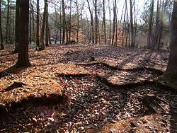
The Quinebaug River Prehistoric Archeological District encompasses a collection of prehistoric archaeological sites near the Quinebaug River in Canterbury, Connecticut. The district covers 22 acres (8.9 ha) of state-owned land on the west bank of the river, east of Connecticut Route 169 south of Connecticut Route 14 and north of Connecticut Route 668. Five separate sites with architectural significance were identified in this area during survey wor conducted in the area in 2001 and 2002. The sites range in size from 6.4 acres (2.6 ha) to just 0.25 acres (0.10 ha), with stone finds dating mainly to the Woodland Period. Two of the sites exhibit evidence of Late Archaic occupation, and all are likely to provide additional information through further excavation.
The district was listed on the National Register of Historic Places in 2009.