
Length 48 km | South end: near Buckland Province Québec | |
 | ||
Major cities Saint-Charles-de-Bellechasse, Quebec | ||
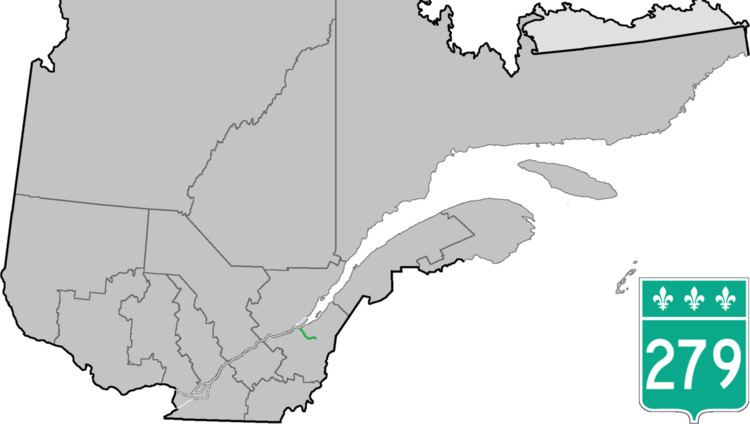
Route 279 is a 48 km two-lane north-south highway in Quebec, Canada, which starts in Beaumont at the junction of Route 132 and ends in Notre-Dame-Auxiliatrice-de-Buckland at the junction of Route 216. The road goes through the Grande Plée Bleue between Beaumont and Saint-Charles-de-Bellechasse, crosses the Boyer River in St-Charles, and slowly goes up the Appalachian Mountains.
Contents
Map of QC-279, Qu%C3%A9bec, Canada
Towns along Route 279
References
Quebec Route 279 Wikipedia(Text) CC BY-SA