
Province Québec | Length 132.6 km | |
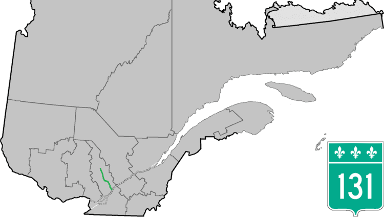 | ||
North end: Chemin du Lac in Saint-Ignace-du-Lac (Saint-Michel-des-Saints) | ||
Route 131 is a Quebec highway running from Lavaltrie (junction of Route 138) to Saint-Michel-des-Saints in Lanaudière. This route, combined with Autoroute 31, provides the key route to Joliette, and then continues northward through Saint-Félix-de-Valois, Saint-Jean-de-Matha and Saint-Zénon for a distance of almost 140 km.
Contents
Map of QC-131, Qu%C3%A9bec, Canada
Municipalities along Route 131
References
Quebec Route 131 Wikipedia(Text) CC BY-SA