
Area 5 acres | ||
 | ||
Public access on private farmland, but a public footpath passes close by to the south | ||
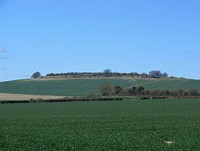
Quarley Hill is the site of an Iron Age univallate hill fort in Hampshire, southern England. The hill affords commanding views of the surrounding countryside. Oval in plan, the fort is in good condition with counter-scarp and well defined entrances at north-east and south-west. It is built on the site of an earlier palisade enclosure. There is evidence of prehistoric activity in area including four large bronze age ditches radiating from the hill fort, believed to be part of a bronze age farming settlement, and a barrow cemetery about a mile away to the north. There is also evidence for a Roman settlement on the north east side of the hill, with Roman coins of Maximum II, and Constantine the Great, and other sherds found 1951.
Contents
Map of Quarley Hill, Andover, UK
Today, the ditches and ramparts are for the most part clear, with the centre of the site giving over to small trees and shrubs.
The site is recorded as a scheduled ancient monument no.67.
Location
The site is located at grid reference SU263423, to the southeast of the village of Quarley, and to the north of the village of Grateley in the county of Hampshire. A Roman road passes just to the south of the hill, running southwest to northeast. The hill's summit is at 172 metres above sea level.